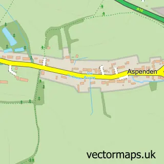
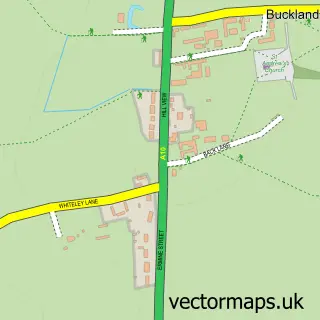
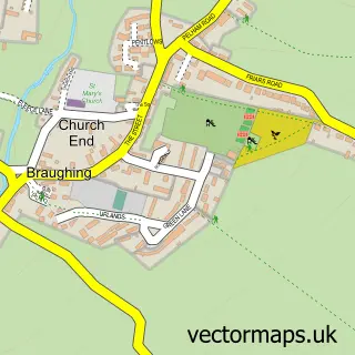
This Buntingford street map is a detailed vector street map covering a 750m x 750m area. Select a larger area to create and download your own vector street map of Buntingford.
The 750-metre map sample for Buntingford covers 541 mapped buildings and approximately 18.7 km of road detail, of which 44 named roads are named. The immediate area includes 2 schools, 6 pubs and 5 MOT stations within 2 miles. The wider area around Buntingford features 4 tourism points of interest and 11 food and drink venues. To create a larger or custom map of Buntingford, the map builder lets you define your own coverage area and download editable SVG, PDF and PNG files.
Create a larger editable map of Buntingford
Choose any area you need and generate a high-quality vector map instantly. Perfect for print, planning, design, business and personal use.

This Buntingford street map in Hertfordshire is available as downloadable SVG, PDF and PNG map files, or as a printed map for planning, business, display, education, local information and design work. You can also create a larger custom map area using the map selector.
What this Buntingford map sample shows
Buntingford lies within Buntingford Cp parish, part of Buntingford ward in the East Hertfordshire District local authority area. The postcode geography for this area includes the SG postcode area, the SG9 postcode district and the SG9 9 postcode sector. Residents fall under the Nhs Hertfordshire And West Essex Integrated Care Board for NHS services.
Local features near Buntingford
Within 2 milesAmenities and services in and around Buntingford.
Administrative and postcode information for Buntingford
The local authority covering Buntingford is East Hertfordshire District, within the county of Hertfordshire. The settlement lies within Buntingford ward and Buntingford Cp civil parish. The SG9 postcode district and SG9 9 postcode sector serve the immediate area. NHS provision in the area is delivered through East And North Hertfordshire Nhs Trust.
Nearby street map samples around Buntingford

More street maps in Hertfordshire
750 metre map area coverage
Boundary, postcode and point of interest information for the 750m x 750m rectangle centred on this sample map.
Boundaries containing map centre
Constituency: North East Hertfordshire Co Const
County: Hertfordshire County
District: East Hertfordshire District
Icb: NHS Central East ICB
Parish: Buntingford CP
Police Force: hertfordshire
Postcode District: SG9
Postcode Sector: SG9 9
Ward: Buntingford Ward
Nearby boundaries intersecting sample
No additional intersecting boundaries found.
Postcode coverage
POI category counts
Professional Services: 8
Real Estate Agent: 8
Beauty Salon: 7
Building Supply Store: 6
Pub: 6
Convenience Store: 5
Hair Salon: 5
Automotive Repair: 4
Church Cathedral: 4
Coffee Shop: 3
Sample points of interest
- Diane Kiff Bookkeeping
- Munns & Co.
- St Peter's, Buntingford
- Amwell Systems
- Gunstock Joinery
- Claire Costello Events
- PayPoint
- The Cooperative Food Buntingford
- Blakeney Motorsport Ltd
- P&N Vehicle Body Repairs Ltd
- PPP Tuning
- RTR motor group
Create a larger editable map of Buntingford
This sample shows only a 750 metre area. To create a larger map of Buntingford, use our map builder to choose your own coverage area, add titles and download editable SVG, PDF and PNG files.
Create a custom map of Buntingford