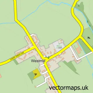
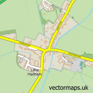
This Braughing street map is a detailed vector street map covering a 750m x 750m area. Select a larger area to create and download your own vector street map of Braughing.
The 750-metre map sample for Braughing covers 178 mapped buildings and approximately 10.0 km of road detail, of which 14 named roads are named. The immediate area includes 1 school, 1 GP surgery within 2 miles and 1 pub. The wider area around Braughing features 1 tourism point of interest and 2 food and drink venues. To create a larger or custom map of Braughing, the map builder lets you define your own coverage area and download editable SVG, PDF and PNG files.
Create a larger editable map of Braughing
Choose any area you need and generate a high-quality vector map instantly. Perfect for print, planning, design, business and personal use.

This Braughing street map in Hertfordshire is available as downloadable SVG, PDF and PNG map files, or as a printed map for planning, business, display, education, local information and design work. You can also create a larger custom map area using the map selector.
What this Braughing map sample shows
Braughing lies within Braughing Cp parish, part of Braughing ward in the East Hertfordshire District local authority area. The postcode geography for this area includes the SG postcode area, the SG11 postcode district and the SG11 2 postcode sector. Residents fall under the Nhs Hertfordshire And West Essex Integrated Care Board for NHS services.
Local features near Braughing
Within 2 milesAmenities and services in and around Braughing.
Administrative and postcode information for Braughing
Braughing lies within Braughing Cp parish, part of Braughing ward in the East Hertfordshire District local authority area. The postcode geography for this area includes the SG postcode area, the SG11 postcode district and the SG11 2 postcode sector. Residents fall under the Nhs Hertfordshire And West Essex Integrated Care Board for NHS services.
Nearby street map samples around Braughing

More street maps in Hertfordshire
750 metre map area coverage
Boundary, postcode and point of interest information for the 750m x 750m rectangle centred on this sample map.
Boundaries containing map centre
Constituency: North East Hertfordshire Co Const
County: Hertfordshire County
District: East Hertfordshire District
Icb: NHS Central East ICB
Parish: Braughing CP
Police Force: hertfordshire
Postcode District: SG11
Postcode Sector: SG11 2
Ward: Braughing & Standon Ward
Nearby boundaries intersecting sample
No additional intersecting boundaries found.
Postcode coverage
POI category counts
Advertising Agency: 2
Anglican Church: 1
Bar: 1
Carpenter: 1
Charity Organization: 1
Church Cathedral: 1
Community Center: 1
Elementary School: 1
Flowers And Gifts Shop: 1
Gastropub: 1
Sample points of interest
- Intercentive
- Sole Partners
- St Mary the Virgin, Braughing
- The Catherine Wheel
- Paul Simon Bespoke Woodcraft
- Friends of St Mary’s Church Braughing
- Braughing Church
- Braughing Community Centre
- Jenyns First School and Nursery
- DaisyBelles
- The Brown Bear
- Braughing Playing Field
Create a larger editable map of Braughing
This sample shows only a 750 metre area. To create a larger map of Braughing, use our map builder to choose your own coverage area, add titles and download editable SVG, PDF and PNG files.
Create a custom map of Braughing