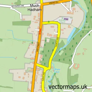
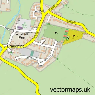
This Little Hadham street map is a detailed vector street map covering a 750m x 750m area. Select a larger area to create and download your own vector street map of Little Hadham.
The 750-metre map sample for Little Hadham covers 150 mapped buildings and approximately 6.5 km of road detail, of which 7 named roads are named. The immediate area includes 1 school and 1 MOT station. To create a larger or custom map of Little Hadham, the map builder lets you define your own coverage area and download editable SVG, PDF and PNG files.
Create a larger editable map of Little Hadham
Choose any area you need and generate a high-quality vector map instantly. Perfect for print, planning, design, business and personal use.

This Little Hadham street map in Hertfordshire is available as downloadable SVG, PDF and PNG map files, or as a printed map for planning, business, display, education, local information and design work. You can also create a larger custom map area using the map selector.
What this Little Hadham map sample shows
Little Hadham lies within Little Hadham Cp parish, part of Little Hadham ward in the East Hertfordshire District local authority area. The postcode geography for this area includes the SG postcode area, the SG11 postcode district and the SG11 2 postcode sector. Residents fall under the Nhs Hertfordshire And West Essex Integrated Care Board for NHS services.
Local features near Little Hadham
Within 2 milesAmenities and services in and around Little Hadham.
Administrative and postcode information for Little Hadham
The local authority covering Little Hadham is East Hertfordshire District, within the county of Hertfordshire. The settlement lies within Little Hadham ward and Little Hadham Cp civil parish. The SG11 postcode district and SG11 2 postcode sector serve the immediate area. NHS provision in the area is delivered through The Princess Alexandra Hospital Nhs Trust.
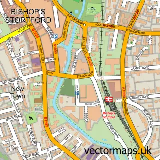
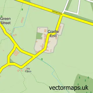
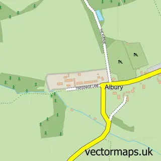
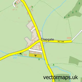
Nearby street map samples around Little Hadham

More street maps in Hertfordshire
750 metre map area coverage
Boundary, postcode and point of interest information for the 750m x 750m rectangle centred on this sample map.
Boundaries containing map centre
Constituency: North East Hertfordshire Co Const
County: Hertfordshire County
District: East Hertfordshire District
Icb: NHS Central East ICB
Parish: Little Hadham CP
Police Force: hertfordshire
Postcode District: SG11
Postcode Sector: SG11 2
Ward: Little Hadham & The Pelhams Ward
Nearby boundaries intersecting sample
No additional intersecting boundaries found.
Postcode coverage
POI category counts
Appliance Repair Service: 1
Building Supply Store: 1
Chimney Sweep: 1
Computer Store: 1
Elementary School: 1
Farmers Market: 1
Laboratory Testing: 1
Occupational Safety: 1
Professional Services: 1
Property Management: 1
Sample points of interest
- Hadham AGA Services
- Lushlandscapes
- Bishop's Stortford Chimney Services
- Clocktower
- Little Hadham Primary School
- Little Hadham Farmers Market
- Hadham Motor Company
- Impact Compliance Solutions
- World Wide Brand Development
- Lime Property Ltd
- Jmi & Nursery School
Create a larger editable map of Little Hadham
This sample shows only a 750 metre area. To create a larger map of Little Hadham, use our map builder to choose your own coverage area, add titles and download editable SVG, PDF and PNG files.
Create a custom map of Little Hadham