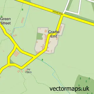
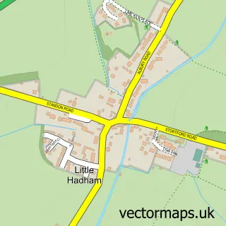
This Bishop's Stortford street map is a detailed vector street map covering a 750m x 750m area. Select a larger area to create and download your own vector street map of Bishop's Stortford.
The 750-metre map sample for Bishop's Stortford covers 375 mapped buildings and approximately 18.0 km of road detail, of which 54 named roads are named. The immediate area includes 1 railway station, 2 GP surgeries, with 3 within 2 miles, 12 pubs and 2 MOT stations, with 17 within 2 miles. The wider area around Bishop's Stortford features 5 tourism points of interest, 56 food and drink venues and 1 campsite within 2 miles. To create a larger or custom map of Bishop's Stortford, the map builder lets you define your own coverage area and download editable SVG, PDF and PNG files.
Create a larger editable map of Bishop's Stortford
Choose any area you need and generate a high-quality vector map instantly. Perfect for print, planning, design, business and personal use.

This Bishop's Stortford street map in Hertfordshire is available as downloadable SVG, PDF and PNG map files, or as a printed map for planning, business, display, education, local information and design work. You can also create a larger custom map area using the map selector.
What this Bishop's Stortford map sample shows
Bishop's Stortford lies within Bishop's Stortford Cp parish, part of Bishop's Stortford Meads ward in the East Hertfordshire District local authority area. The postcode geography for this area includes the CM postcode area, the CM23 postcode district and the CM23 2 postcode sector. Residents fall under the Nhs Hertfordshire And West Essex Integrated Care Board for NHS services.
Local features near Bishop's Stortford
Within 2 milesAmenities and services in and around Bishop's Stortford.
Administrative and postcode information for Bishop's Stortford
The local authority covering Bishop's Stortford is East Hertfordshire District, within the county of Hertfordshire. The settlement lies within Bishop's Stortford Meads ward and Bishop's Stortford Cp civil parish. The CM23 postcode district and CM23 2 postcode sector serve the immediate area. NHS provision in the area is delivered through The Princess Alexandra Hospital Nhs Trust.
Nearby street map samples around Bishop's Stortford


More street maps in Hertfordshire
750 metre map area coverage
Boundary, postcode and point of interest information for the 750m x 750m rectangle centred on this sample map.
Boundaries containing map centre
Constituency: Hertford and Stortford Co Const
County: Hertfordshire County
District: East Hertfordshire District
Icb: NHS Central East ICB
Parish: Bishop's Stortford CP
Police Force: hertfordshire
Postcode District: CM23
Postcode Sector: CM23 3
Ward: Bishop's Stortford All Saints Ward
Nearby boundaries intersecting sample
Postcode Sector: CM23 2, CM23 5
Ward: Bishop's Stortford Central Ward, Bishop's Stortford North Ward, Bishop's Stortford Parsonage Ward
Postcode coverage
POI category counts
Beauty Salon: 18
Clothing Store: 18
Restaurant: 17
Cafe: 14
Coffee Shop: 13
Real Estate Agent: 13
Barber: 12
Professional Services: 12
Pub: 12
Employment Agencies: 11
Sample points of interest
- Ascott Blake
- Mansell & Co
- Mansell & Co.
- Perrys Montpelier Chartered Accountants
- Price Bailey
- Redbox Accountancy
- TaxAssist Accountants
- Bounce Bed Reformer Pilates
- Business Kinetics
- C Z Design & Print
- Downton Consulting
- Kube Design
Create a larger editable map of Bishop's Stortford
This sample shows only a 750 metre area. To create a larger map of Bishop's Stortford, use our map builder to choose your own coverage area, add titles and download editable SVG, PDF and PNG files.
Create a custom map of Bishop's Stortford