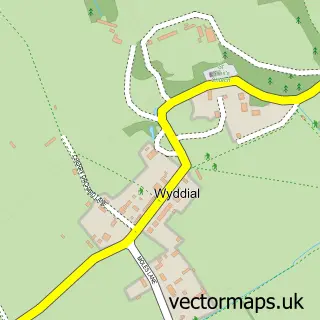
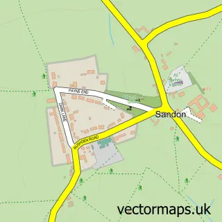
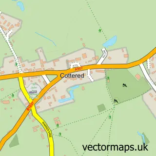
This Buckland street map is a detailed vector street map covering a 750m x 750m area. Select a larger area to create and download your own vector street map of Buckland.
The 750-metre map sample for Buckland covers 69 mapped buildings and approximately 13.7 km of road detail, of which 5 named roads are named. The immediate area includes 1 MOT station within 2 miles. The wider area around Buckland features 1 hotel. To create a larger or custom map of Buckland, the map builder lets you define your own coverage area and download editable SVG, PDF and PNG files.
Create a larger editable map of Buckland
Choose any area you need and generate a high-quality vector map instantly. Perfect for print, planning, design, business and personal use.

This Buckland street map in Hertfordshire is available as downloadable SVG, PDF and PNG map files, or as a printed map for planning, business, display, education, local information and design work. You can also create a larger custom map area using the map selector.
What this Buckland map sample shows
Buckland lies within Buckland Cp parish, part of Buntingford ward in the East Hertfordshire District local authority area. The postcode geography for this area includes the SG postcode area, the SG9 postcode district and the SG9 0 postcode sector. Residents fall under the Nhs Hertfordshire And West Essex Integrated Care Board for NHS services.
Local features near Buckland
Within 2 milesAmenities and services in and around Buckland.
Administrative and postcode information for Buckland
Buckland lies within Buckland Cp parish, part of Buntingford ward in the East Hertfordshire District local authority area. The postcode geography for this area includes the SG postcode area, the SG9 postcode district and the SG9 0 postcode sector. Residents fall under the Nhs Hertfordshire And West Essex Integrated Care Board for NHS services.
Nearby street map samples around Buckland

More street maps in Hertfordshire
750 metre map area coverage
Boundary, postcode and point of interest information for the 750m x 750m rectangle centred on this sample map.
Boundaries containing map centre
Constituency: North East Hertfordshire Co Const
County: Hertfordshire County
District: East Hertfordshire District
Icb: NHS Central East ICB
Parish: Buckland CP
Police Force: hertfordshire
Postcode District: SG9
Postcode Sector: SG9 0
Ward: Buntingford Ward
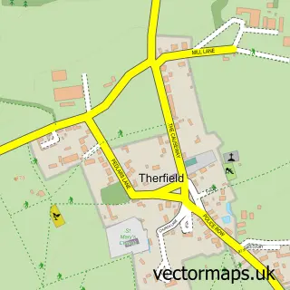
Nearby boundaries intersecting sample
District: North Hertfordshire District
Parish: Therfield CP
Ward: Ermine Ward
Postcode coverage
POI category counts
Anglican Church: 1
Building Supply Store: 1
Car Rental Agency: 1
Construction Services: 1
Gift Shop: 1
Hotel: 1
Machine And Tool Rentals: 1
Sample points of interest
- St Andrew's Church
- Wyldwood Flooring
- Herts Rental Group
- PJS Builders
- Christmas at Buckland Barn
- Buckland House
- Buckland Plant Hire
Create a larger editable map of Buckland
This sample shows only a 750 metre area. To create a larger map of Buckland, use our map builder to choose your own coverage area, add titles and download editable SVG, PDF and PNG files.
Create a custom map of Buckland