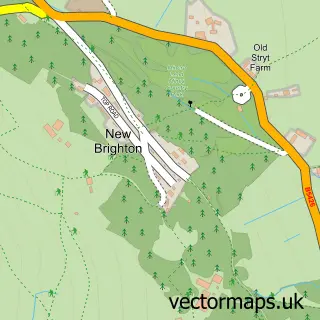
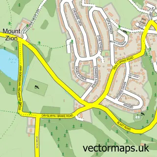
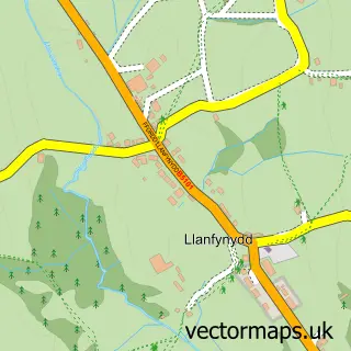
This Bwlchgwyn street map is a detailed vector street map covering a 750m x 750m area. Select a larger area to create and download your own vector street map of Bwlchgwyn.
The 750-metre map sample for Bwlchgwyn covers 229 mapped buildings and approximately 11.4 km of road detail, of which 11 named roads are named. The immediate area includes 1 GP surgery within 2 miles, 1 pub and 1 MOT station within 2 miles. The wider area around Bwlchgwyn features 1 tourism point of interest and 1 food and drink venue. To create a larger or custom map of Bwlchgwyn, the map builder lets you define your own coverage area and download editable SVG, PDF and PNG files.
Create a larger editable map of Bwlchgwyn
Choose any area you need and generate a high-quality vector map instantly. Perfect for print, planning, design, business and personal use.

This Bwlchgwyn street map in Clwyd is available as downloadable SVG, PDF and PNG map files, or as a printed map for planning, business, display, education, local information and design work. You can also create a larger custom map area using the map selector.
What this Bwlchgwyn map sample shows
Bwlchgwyn lies within Brymbo Community parish, part of Minera ward in the Wrecsam - Wrexham local authority area. The postcode geography for this area includes the LL postcode area, the LL11 postcode district and the LL11 5 postcode sector. Residents fall under the Betsi Cadwaladr University Health Board for NHS services.
Local features near Bwlchgwyn
Within 2 milesAmenities and services in and around Bwlchgwyn.
Administrative and postcode information for Bwlchgwyn
The local authority covering Bwlchgwyn is Wrecsam - Wrexham, within the county of Clwyd. The settlement lies within Minera ward and Brymbo Community civil parish. The LL11 postcode district and LL11 5 postcode sector serve the immediate area. NHS provision in the area is delivered through Betsi Cadwaladr University Health Board.
Nearby street map samples around Bwlchgwyn

More street maps in Clwyd
750 metre map area coverage
Boundary, postcode and point of interest information for the 750m x 750m rectangle centred on this sample map.
Boundaries containing map centre
Constituency: Wrexham Co Const
District: Wrecsam - Wrexham
Icb: Betsi Cadwaladr University
Parish: Brymbo Community
Police Force: north wales
Postcode District: LL11
Postcode Sector: LL11 5
Nearby boundaries intersecting sample
Constituency: Alyn and Deeside Co Const
District: Sir y Fflint - Flintshire
Parish: Llanfynydd Community
Postcode coverage
POI category counts
Building Supply Store: 2
Bar: 1
Business Consulting: 1
Community Center: 1
Corporate Entertainment Services: 1
Driving School: 1
Elementary School: 1
Hvac Services: 1
International Business And Trade Services: 1
Karate Club: 1
Sample points of interest
- Moors Inn
- DSL Plumbing & Heating
- DSL Plumbing & Heating
- CA Select Limited
- Bwlchgwyn Village Hall
- Motor Safari Morgan Events
- Jupiter Driving School
- Mind Friendly Learning
- The Wright Plumbing & Heating UK
- Period Property Solutions
- Bwlchgwyn Karate Club
- Aircrew LA766 Memorial
Create a larger editable map of Bwlchgwyn
This sample shows only a 750 metre area. To create a larger map of Bwlchgwyn, use our map builder to choose your own coverage area, add titles and download editable SVG, PDF and PNG files.
Create a custom map of Bwlchgwyn