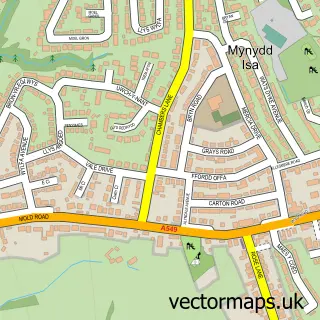
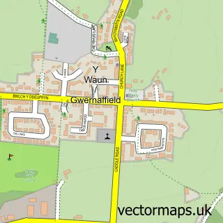
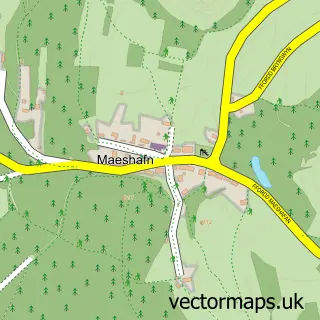
This Mold street map is a detailed vector street map covering a 750m x 750m area. Select a larger area to create and download your own vector street map of Mold.
The 750-metre map sample for Mold covers 349 mapped buildings and approximately 19.3 km of road detail, of which 43 named roads are named. The immediate area includes 2 schools, 1 GP surgery, 11 pubs and 2 MOT stations, with 7 within 2 miles. The wider area around Mold features 4 tourism points of interest, 32 food and drink venues and 4 hotels. To create a larger or custom map of Mold, the map builder lets you define your own coverage area and download editable SVG, PDF and PNG files.
Create a larger editable map of Mold
Choose any area you need and generate a high-quality vector map instantly. Perfect for print, planning, design, business and personal use.

This Mold street map in Clwyd is available as downloadable SVG, PDF and PNG map files, or as a printed map for planning, business, display, education, local information and design work. You can also create a larger custom map area using the map selector.
What this Mold map sample shows
Mold lies within Mold Community parish, part of Mold East ward in the Sir Y Fflint - Flintshire local authority area. The postcode geography for this area includes the CH postcode area, the CH7 postcode district and the CH7 1 postcode sector. Residents fall under the Betsi Cadwaladr University Health Board for NHS services.
Local features near Mold
Within 2 milesAmenities and services in and around Mold.
Administrative and postcode information for Mold
Mold lies within Mold Community parish, part of Mold East ward in the Sir Y Fflint - Flintshire local authority area. The postcode geography for this area includes the CH postcode area, the CH7 postcode district and the CH7 1 postcode sector. Residents fall under the Betsi Cadwaladr University Health Board for NHS services.
Nearby street map samples around Mold

More street maps in Clwyd
750 metre map area coverage
Boundary, postcode and point of interest information for the 750m x 750m rectangle centred on this sample map.
Boundaries containing map centre
Constituency: Clwyd East Co Const
District: Sir y Fflint - Flintshire
Icb: Betsi Cadwaladr University
Parish: Mold Community
Police Force: north wales
Postcode District: CH7
Postcode Sector: CH7 1
Nearby boundaries intersecting sample
No additional intersecting boundaries found.
Postcode coverage
POI category counts
Beauty Salon: 26
Hair Salon: 14
Clothing Store: 13
Pub: 12
Real Estate Agent: 12
Barber: 10
Cafe: 10
Fast Food Restaurant: 10
Bank Credit Union: 9
Retail: 9
Sample points of interest
- Compacc
- Hicks Randles
- P & L Accountancy
- Happy Lotus Acupuncture
- Pro PPC
- Sigma Web
- Hypnotherapy Centre
- Inside Out Wellness
- Janet Beech
- The Park Clinic
- Chicago's American Eatery
- Mitchells
Create a larger editable map of Mold
This sample shows only a 750 metre area. To create a larger map of Mold, use our map builder to choose your own coverage area, add titles and download editable SVG, PDF and PNG files.
Create a custom map of Mold