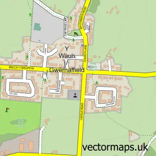
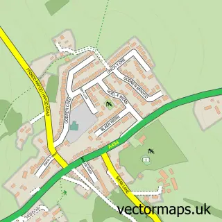
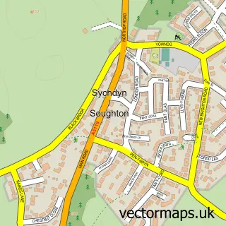
This Pantymwyn street map is a detailed vector street map covering a 750m x 750m area. Select a larger area to create and download your own vector street map of Pantymwyn.
The 750-metre map sample for Pantymwyn covers 248 mapped buildings and approximately 9.0 km of road detail, of which 8 named roads are named. The immediate area includes 1 pub and 3 MOT stations within 2 miles. The wider area around Pantymwyn features 1 tourism point of interest and 1 food and drink venue. To create a larger or custom map of Pantymwyn, the map builder lets you define your own coverage area and download editable SVG, PDF and PNG files.
Create a larger editable map of Pantymwyn
Choose any area you need and generate a high-quality vector map instantly. Perfect for print, planning, design, business and personal use.

This Pantymwyn street map in Clwyd is available as downloadable SVG, PDF and PNG map files, or as a printed map for planning, business, display, education, local information and design work. You can also create a larger custom map area using the map selector.
What this Pantymwyn map sample shows
Pantymwyn lies within Gwernaffield With Pantymwyn Community parish, part of Gwernaffield ward in the Sir Y Fflint - Flintshire local authority area. The postcode geography for this area includes the CH postcode area, the CH7 postcode district and the CH7 5 postcode sector. Residents fall under the Betsi Cadwaladr University Health Board for NHS services.
Local features near Pantymwyn
Within 2 milesAmenities and services in and around Pantymwyn.
Administrative and postcode information for Pantymwyn
The local authority covering Pantymwyn is Sir Y Fflint - Flintshire, within the county of Clwyd. The settlement lies within Gwernaffield ward and Gwernaffield With Pantymwyn Community civil parish. The CH7 postcode district and CH7 5 postcode sector serve the immediate area. NHS provision in the area is delivered through Betsi Cadwaladr University Health Board.
Nearby street map samples around Pantymwyn

More street maps in Clwyd
750 metre map area coverage
Boundary, postcode and point of interest information for the 750m x 750m rectangle centred on this sample map.
Boundaries containing map centre
Constituency: Clwyd East Co Const
District: Sir y Fflint - Flintshire
Icb: Betsi Cadwaladr University
Parish: Gwernaffield with Pantymwyn Community
Police Force: north wales
Postcode District: CH7
Postcode Sector: CH7 5
Nearby boundaries intersecting sample
No additional intersecting boundaries found.
Postcode coverage
POI category counts
Building Supply Store: 2
Alternative Medicine: 1
Automotive: 1
Business Management Services: 1
Golf Course: 1
Kitchen Remodeling: 1
Packing Supply: 1
Park: 1
Pub: 1
Shipping Center: 1
Sample points of interest
- Aloe Vera Natural Health
- Fraser Chadwick Motors
- Seddons Electrical
- Sustain Architecture
- Source 2 Supply
- Mold Golf Club
- Home Enhancement Kitchens
- Source 2 Supply
- Pantymwyn Caravan Park
- The Crown Inn
- Pantymwyn Post Office
- Craig Tudor Golf
Create a larger editable map of Pantymwyn
This sample shows only a 750 metre area. To create a larger map of Pantymwyn, use our map builder to choose your own coverage area, add titles and download editable SVG, PDF and PNG files.
Create a custom map of Pantymwyn