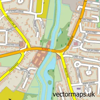
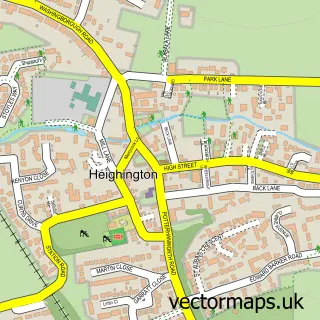
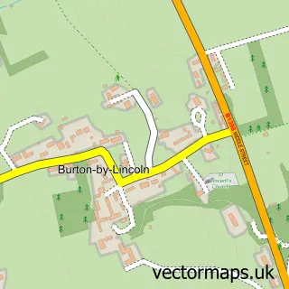
This Canwick street map is a detailed vector street map covering a 750m x 750m area. Select a larger area to create and download your own vector street map of Canwick.
The 750-metre map sample for Canwick covers 151 mapped buildings and approximately 14.5 km of road detail, of which 15 named roads are named. The immediate area includes 7 GP surgeries within 2 miles and 40 MOT stations within 2 miles. The wider area around Canwick features 1 hotel. To create a larger or custom map of Canwick, the map builder lets you define your own coverage area and download editable SVG, PDF and PNG files.
Create a larger editable map of Canwick
Choose any area you need and generate a high-quality vector map instantly. Perfect for print, planning, design, business and personal use.

This Canwick street map in Lincolnshire is available as downloadable SVG, PDF and PNG map files, or as a printed map for planning, business, display, education, local information and design work. You can also create a larger custom map area using the map selector.
What this Canwick map sample shows
Canwick lies within Canwick Cp parish, part of Heighington And Washingborough ward in the North Kesteven District local authority area. The postcode geography for this area includes the LN postcode area, the LN4 postcode district and the LN4 2 postcode sector. Residents fall under the Nhs Lincolnshire Integrated Care Board for NHS services.
Local features near Canwick
Within 2 milesAmenities and services in and around Canwick.
Administrative and postcode information for Canwick
Canwick lies within Canwick Cp parish, part of Heighington And Washingborough ward in the North Kesteven District local authority area. The postcode geography for this area includes the LN postcode area, the LN4 postcode district and the LN4 2 postcode sector. Residents fall under the Nhs Lincolnshire Integrated Care Board for NHS services.
Nearby street map samples around Canwick

More street maps in Lincolnshire
750 metre map area coverage
Boundary, postcode and point of interest information for the 750m x 750m rectangle centred on this sample map.
Boundaries containing map centre
Constituency: Sleaford and North Hykeham Co Const
County: Lincolnshire County
District: North Kesteven District
Icb: NHS Lincolnshire ICB
Parish: Canwick CP
Police Force: lincolnshire
Postcode District: LN4
Postcode Sector: LN4 2
Ward: Heighington & Washingborough Ward
Nearby boundaries intersecting sample
Constituency: Lincoln Boro Const
District: Lincoln District (B)
Postcode Sector: LN4 1
Ward: Park Ward
Postcode coverage
POI category counts
Advertising Agency: 1
Anglican Church: 1
Antique Store: 1
Automotive Repair: 1
Boot Camp: 1
British Restaurant: 1
Community Center: 1
Education: 1
Hotel: 1
Land Surveying: 1
Sample points of interest
- Social Stars
- All Saints
- JRS Antique Restorations
- Pitstop
- Summit Outdoor Fitness
- Mill Lodge
- Canwick Village Hall
- Nocton Community School
- The Dower House Apartments Lincoln
- Francis N a
- Lincolnmoneyman.com - Mortgage Broker
- Vibrant Health
Create a larger editable map of Canwick
This sample shows only a 750 metre area. To create a larger map of Canwick, use our map builder to choose your own coverage area, add titles and download editable SVG, PDF and PNG files.
Create a custom map of Canwick