Vector Maps logo
Home Why it works Popular maps Districts Samples Customizer Create Your Map
VectorMaps.uk
Home Popular maps Districts Samples Customizer Create Your Map Privacy Disclaimer
Home / UK Maps / East Riding of Yorkshire / Carnaby Map

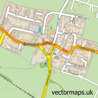
This Carnaby street map is a detailed vector street map covering a 750m x 750m area. Select a larger area to create and download your own vector street map of Carnaby.

Carnaby is a village in East Riding Of Yorkshire, in the Yorkshire And The Humber of England. Historically, the area formed part of Yorkshire. The settlement falls within the East Yorkshire parliamentary constituency. It is served by the YO16 postcode dis

The 750-metre map sample for Carnaby covers 130 mapped buildings and approximately 13.8 km of road detail, of which 9 named roads are named. The immediate area includes 4 MOT stations within 2 miles. The wider area around Carnaby features 1 tourism point of interest, 2 hotels and 2 campsites within 2 miles. To create a larger or custom map of Carnaby, the map builder lets you define your own coverage area and download editable SVG, PDF and PNG files.

130Buildings
13.8 kmRoads
9Named roads
2,291Residents within 2 miles
Create your own

Create a larger editable map of Carnaby

Choose any area you need and generate a high-quality vector map instantly. Perfect for print, planning, design, business and personal use.

Choose any location
Editable SVG files
Any size up to A0
PDF, PNG & more
Instant download
High quality guaranteed
Create My Custom Map
Secure, private & no credit card required
Carnaby Vector Street Map
750m Sample
Carnaby vector street map sample showing roads, buildings and local features in a 750 metre preview area
Buy Carnaby Map Print from £12.95 Buy Carnaby Digital Map from £6

This Carnaby street map in East Riding of Yorkshire is available as downloadable SVG, PDF and PNG map files, or as a printed map for planning, business, display, education, local information and design work. You can also create a larger custom map area using the map selector.

What this Carnaby map sample shows

Carnaby lies within Carnaby Cp parish, part of East Wolds And Coastal ward in the East Riding Of Yorkshire local authority area. The postcode geography for this area includes the YO postcode area, the YO16 postcode district and the YO16 4 postcode sector. Residents fall under the Nhs Humber And North Yorkshire Integrated Care Board for NHS services.

Local features near Carnaby

Within 2 miles

Amenities and services in and around Carnaby.

2 Campsites within 2 miles
4 MOT stations within 2 miles
1 Tourism & leisure
2 Hotels

Counts are approximate and based on publicly available data.

Administrative and postcode information for Carnaby

Carnaby lies within Carnaby Cp parish, part of East Wolds And Coastal ward in the East Riding Of Yorkshire local authority area. The postcode geography for this area includes the YO postcode area, the YO16 postcode district and the YO16 4 postcode sector. Residents fall under the Nhs Humber And North Yorkshire Integrated Care Board for NHS services.

Parish Carnaby CP
Ward East Wolds and Coastal
District / local authority East Riding of Yorkshire
County East Riding of Yorkshire
Historic county Yorkshire
Postcode district YO16
Postcode sector YO16 4
Parliamentary constituency East Yorkshire
Region Yorkshire and the Humber
Country England

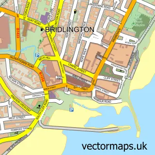
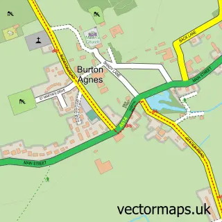
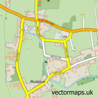
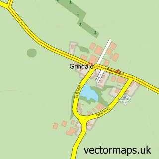
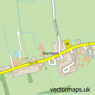
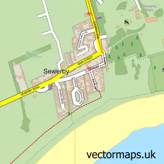
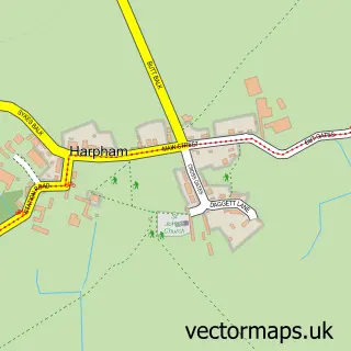
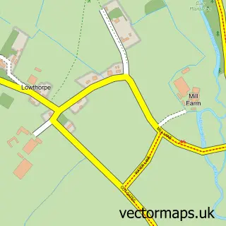
Nearby street map samples around Carnaby

Street map sample of Bridlington, East Riding of Yorkshire Bridlington Town - East Riding of Yorkshire - 2.5 miles Street map sample of Hull, East Riding of Yorkshire Hull City - East Riding of Yorkshire - 22.9 miles Street map sample of Burton Agnes, East Riding of Yorkshire Burton Agnes Village - East Riding of Yorkshire - 3.0 miles Street map sample of Rudston, East Riding of Yorkshire Rudston Village - East Riding of Yorkshire - 3.3 miles Street map sample of Grindale, East Riding of Yorkshire Grindale Village - East Riding of Yorkshire - 3.8 miles Street map sample of Barmston, East Riding of Yorkshire Barmston Village - East Riding of Yorkshire - 4.0 miles Street map sample of Sewerby, East Riding of Yorkshire Sewerby Village - East Riding of Yorkshire - 4.0 miles Street map sample of Harpham, East Riding of Yorkshire Harpham Village - East Riding of Yorkshire - 4.0 miles Street map sample of Lowthorpe, East Riding of Yorkshire Lowthorpe Village - East Riding of Yorkshire - 4.8 miles Street map sample of Bempton, East Riding of Yorkshire Bempton Village - East Riding of Yorkshire - 5.0 miles

More street maps in East Riding of Yorkshire

Street map sample of Bridlington, East Riding of Yorkshire Bridlington Town - 2.5 miles Street map sample of Burton Agnes, East Riding of Yorkshire Burton Agnes Village - 3.0 miles Street map sample of Rudston, East Riding of Yorkshire Rudston Village - 3.3 miles Street map sample of Grindale, East Riding of Yorkshire Grindale Village - 3.8 miles Street map sample of Barmston, East Riding of Yorkshire Barmston Village - 4.0 miles

750 metre map area coverage

Boundary, postcode and point of interest information for the 750m x 750m rectangle centred on this sample map.

Boundaries containing map centre

Constituency: Bridlington and The Wolds Co Const

District: East Riding of Yorkshire

Icb: NHS Humber and North Yorkshire ICB

Parish: Carnaby CP

Police Force: humberside

Postcode District: YO16

Postcode Sector: YO16 4

Ward: East Wolds and Coastal Ward

Nearby boundaries intersecting sample

No additional intersecting boundaries found.

Postcode coverage

YO16 YO16 4

POI category counts

Hotel: 2

Roofing: 2

Anglican Church: 1

Arts And Entertainment: 1

Candy Store: 1

Farming Services: 1

Hat Shop: 1

Holiday Rental Home: 1

Italian Restaurant: 1

Park: 1

Sample points of interest

  • St John the Baptist Carnaby Anglican Church
  • The Cafe at Park Rose Arts And Entertainment
  • Tricky treats ltd Candy Store
  • Gold From The Wold Farming Services
  • What a Hat Hat Shop
  • Lodge 37 Bridlington Holiday Park Holiday Rental Home
  • Ferns Farm Hotel Hotel
  • Manor Court Hotel Hotel
  • Azzuro Italian Restaurant
  • Little Eden Holiday Lodge Park Park
  • Palms Leisure Club Private Association
  • Gold From the Wold Professional Services

Create a larger editable map of Carnaby

This sample shows only a 750 metre area. To create a larger map of Carnaby, use our map builder to choose your own coverage area, add titles and download editable SVG, PDF and PNG files.

Create a custom map of Carnaby

Phone 01751 473136 | Copyright Vectormaps.uk 2026

Samples Customizer Privacy Disclaimer
Carnaby Vector Street Map
Carnaby enlarged street map sample showing a 750 metre preview area