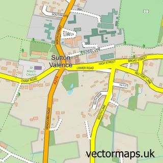
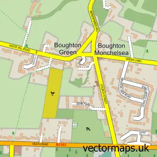
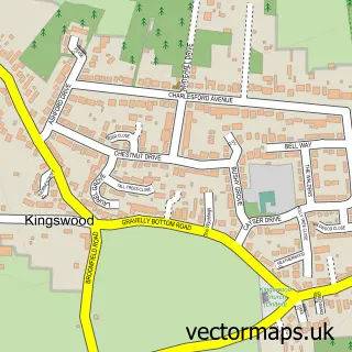
This Chart Sutton street map is a detailed vector street map covering a 750m x 750m area. Select a larger area to create and download your own vector street map of Chart Sutton.
The 750-metre map sample for Chart Sutton covers 166 mapped buildings and approximately 8.0 km of road detail, of which 8 named roads are named. The immediate area includes 4 GP surgeries within 2 miles and 1 MOT station, with 14 within 2 miles. The wider area around Chart Sutton features 2 tourism points of interest and 1 campsite within 2 miles. To create a larger or custom map of Chart Sutton, the map builder lets you define your own coverage area and download editable SVG, PDF and PNG files.
Create a larger editable map of Chart Sutton
Choose any area you need and generate a high-quality vector map instantly. Perfect for print, planning, design, business and personal use.

This Chart Sutton street map in Kent is available as downloadable SVG, PDF and PNG map files, or as a printed map for planning, business, display, education, local information and design work. You can also create a larger custom map area using the map selector.
What this Chart Sutton map sample shows
Chart Sutton lies within Chart Sutton Cp parish, part of Boughton Monchelsea And Chart Sutton ward in the Maidstone District (B) local authority area. The postcode geography for this area includes the ME postcode area, the ME17 postcode district and the ME17 3 postcode sector. Residents fall under the Nhs Kent And Medway Integrated Care Board for NHS services.
Local features near Chart Sutton
Within 2 milesAmenities and services in and around Chart Sutton.
Administrative and postcode information for Chart Sutton
Chart Sutton lies within Chart Sutton Cp parish, part of Boughton Monchelsea And Chart Sutton ward in the Maidstone District (B) local authority area. The postcode geography for this area includes the ME postcode area, the ME17 postcode district and the ME17 3 postcode sector. Residents fall under the Nhs Kent And Medway Integrated Care Board for NHS services.
Nearby street map samples around Chart Sutton

More street maps in Kent
750 metre map area coverage
Boundary, postcode and point of interest information for the 750m x 750m rectangle centred on this sample map.
Boundaries containing map centre
Constituency: Weald of Kent Co Const
County: Kent County
District: Maidstone District (B)
Icb: NHS Kent and Medway ICB
Parish: Chart Sutton CP
Police Force: kent
Postcode District: ME17
Postcode Sector: ME17 3
Ward: Boughton Monchelsea & Chart Sutton Ward
Nearby boundaries intersecting sample
No additional intersecting boundaries found.
Postcode coverage
POI category counts
Post Office: 2
Advertising Agency: 1
Antique Store: 1
Cinema: 1
Community Center: 1
Construction Services: 1
Contractor: 1
Counseling And Mental Health: 1
Dance School: 1
Doctor: 1
Sample points of interest
- N-Fuze Design
- Chart Sutton Antiques & Collectables
- The Sunbeam Barn
- Chart Sutton Village Hall
- Restoring Homes Limited
- Advance M & E Services
- Restoring Health
- Lets Dance Uk
- Sutton Valence Group Practice
- 365 Electrics Ltd.
- Wisdom Transport Consultants
- Plane & Simple
Create a larger editable map of Chart Sutton
This sample shows only a 750 metre area. To create a larger map of Chart Sutton, use our map builder to choose your own coverage area, add titles and download editable SVG, PDF and PNG files.
Create a custom map of Chart Sutton