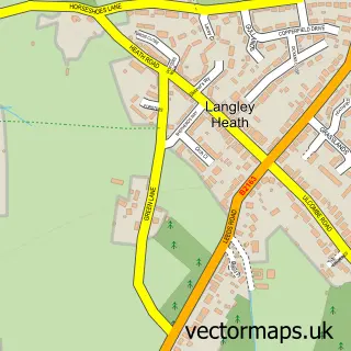
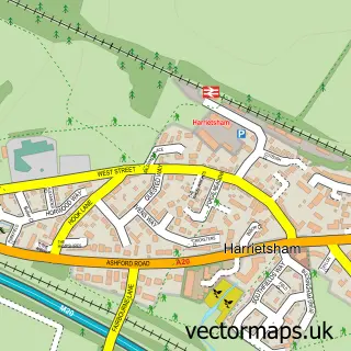
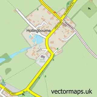
This Kingswood street map is a detailed vector street map covering a 750m x 750m area. Select a larger area to create and download your own vector street map of Kingswood.
The 750-metre map sample for Kingswood covers 389 mapped buildings and approximately 14.7 km of road detail, of which 25 named roads are named. The immediate area includes 1 school, 2 GP surgeries within 2 miles and 3 MOT stations within 2 miles. The wider area around Kingswood features 1 campsite within 2 miles. To create a larger or custom map of Kingswood, the map builder lets you define your own coverage area and download editable SVG, PDF and PNG files.
Create a larger editable map of Kingswood
Choose any area you need and generate a high-quality vector map instantly. Perfect for print, planning, design, business and personal use.

This Kingswood street map in Kent is available as downloadable SVG, PDF and PNG map files, or as a printed map for planning, business, display, education, local information and design work. You can also create a larger custom map area using the map selector.
What this Kingswood map sample shows
Kingswood lies within Broomfield And Kingswood Cp parish, part of Leeds ward in the Maidstone District (B) local authority area. The postcode geography for this area includes the ME postcode area, the ME17 postcode district and the ME17 3 postcode sector. Residents fall under the Nhs Kent And Medway Integrated Care Board for NHS services.
Local features near Kingswood
Within 2 milesAmenities and services in and around Kingswood.
Administrative and postcode information for Kingswood
The local authority covering Kingswood is Maidstone District (B), within the county of Kent. The settlement lies within Leeds ward and Broomfield And Kingswood Cp civil parish. The ME17 postcode district and ME17 3 postcode sector serve the immediate area. NHS provision in the area is delivered through Maidstone And Tunbridge Wells Nhs Trust.
Nearby street map samples around Kingswood

More street maps in Kent
750 metre map area coverage
Boundary, postcode and point of interest information for the 750m x 750m rectangle centred on this sample map.
Boundaries containing map centre
Constituency: Faversham and Mid Kent Co Const
County: Kent County
District: Maidstone District (B)
Icb: NHS Kent and Medway ICB
Parish: Broomfield and Kingswood CP
Police Force: kent
Postcode District: ME17
Postcode Sector: ME17 3
Ward: Leeds & Langley Ward
Nearby boundaries intersecting sample
Postcode Sector: ME17 1
Ward: Headcorn & Sutton Valence Ward
Postcode coverage
POI category counts
Convenience Store: 2
Post Office: 2
Anglican Church: 1
Automotive Repair: 1
Bakery: 1
Beauty And Spa: 1
Beauty Salon: 1
Bridal Shop: 1
Building Supply Store: 1
Carpenter: 1
Sample points of interest
- Kingswood United Church
- K & J Mobile Tuning and Servicing
- Dottie Macarons
- Santabelle Beauty
- Nicky's Beauty Services
- Nickys Bridal Services
- RLR Fencing & Decking
- Ken Brown
- A R Plastering
- New Avenue Stores
- Nisa Local
- Worktop Wizards
Create a larger editable map of Kingswood
This sample shows only a 750 metre area. To create a larger map of Kingswood, use our map builder to choose your own coverage area, add titles and download editable SVG, PDF and PNG files.
Create a custom map of Kingswood