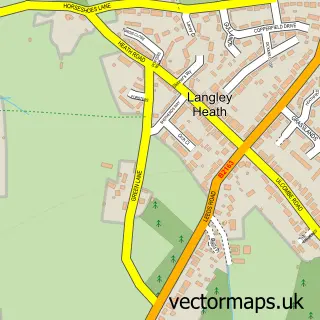
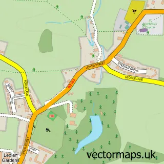
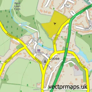
This Langley street map is a detailed vector street map covering a 750m x 750m area. Select a larger area to create and download your own vector street map of Langley.
The 750-metre map sample for Langley covers 77 mapped buildings and approximately 8.3 km of road detail, of which 3 named roads are named. The immediate area includes 5 GP surgeries within 2 miles and 13 MOT stations within 2 miles. The wider area around Langley features 1 campsite within 2 miles. To create a larger or custom map of Langley, the map builder lets you define your own coverage area and download editable SVG, PDF and PNG files.
Create a larger editable map of Langley
Choose any area you need and generate a high-quality vector map instantly. Perfect for print, planning, design, business and personal use.

This Langley street map in Kent is available as downloadable SVG, PDF and PNG map files, or as a printed map for planning, business, display, education, local information and design work. You can also create a larger custom map area using the map selector.
What this Langley map sample shows
Langley lies within Langley Cp parish, part of Sutton Valence And Langley ward in the Maidstone District (B) local authority area. The postcode geography for this area includes the ME postcode area, the ME17 postcode district and the ME17 3 postcode sector. Residents fall under the Nhs Kent And Medway Integrated Care Board for NHS services.
Local features near Langley
Within 2 milesAmenities and services in and around Langley.
Administrative and postcode information for Langley
Langley lies within Langley Cp parish, part of Sutton Valence And Langley ward in the Maidstone District (B) local authority area. The postcode geography for this area includes the ME postcode area, the ME17 postcode district and the ME17 3 postcode sector. Residents fall under the Nhs Kent And Medway Integrated Care Board for NHS services.
Nearby street map samples around Langley

More street maps in Kent
750 metre map area coverage
Boundary, postcode and point of interest information for the 750m x 750m rectangle centred on this sample map.
Boundaries containing map centre
Constituency: Weald of Kent Co Const
County: Kent County
District: Maidstone District (B)
Icb: NHS Kent and Medway ICB
Parish: Langley CP
Police Force: kent
Postcode District: ME17
Postcode Sector: ME17 3
Ward: Leeds & Langley Ward
Nearby boundaries intersecting sample
No additional intersecting boundaries found.
Postcode coverage
POI category counts
Farm: 2
Assisted Living Facility: 1
Automotive Parts And Accessories: 1
Building Supply Store: 1
Commercial Refrigeration: 1
Cultural Center: 1
Elementary School: 1
Fruits And Vegetables: 1
Nursery And Gardening: 1
Printing Services: 1
Sample points of interest
- Barchester - Rose Water Place Care Home
- Southern Adhesives
- The Stone Tile Warehouse
- Orchard Cooling Limited
- The Maidstone Art Centre
- The Weald School Of Ballet
- Charltons
- Rumwood Green Farm Packhouse Langley Kent
- Total World Fresh
- Rumwood Nurseries and Garden Centre
- We are PrintBigUK
- Rose Water Place Care Home - Barchester Healthcare
Create a larger editable map of Langley
This sample shows only a 750 metre area. To create a larger map of Langley, use our map builder to choose your own coverage area, add titles and download editable SVG, PDF and PNG files.
Create a custom map of Langley