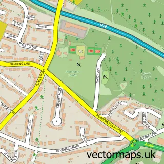
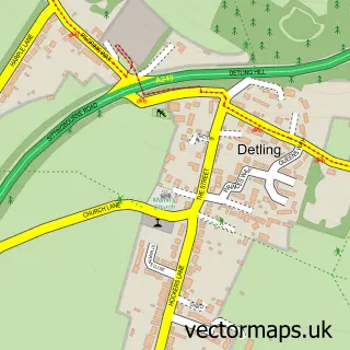
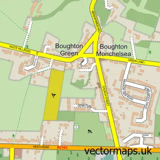
This Maidstone street map is a detailed vector street map covering a 750m x 750m area. Select a larger area to create and download your own vector street map of Maidstone.
The 750-metre map sample for Maidstone covers 173 mapped buildings and approximately 20.4 km of road detail, of which 45 named roads are named. The immediate area includes 1 school, 1 railway station, 1 GP surgery, with 6 within 2 miles and 21 pubs among other local services. The wider area around Maidstone features 7 tourism points of interest, 84 food and drink venues and 6 hotels. To create a larger or custom map of Maidstone, the map builder lets you define your own coverage area and download editable SVG, PDF and PNG files.
Create a larger editable map of Maidstone
Choose any area you need and generate a high-quality vector map instantly. Perfect for print, planning, design, business and personal use.

This Maidstone street map in Kent is available as downloadable SVG, PDF and PNG map files, or as a printed map for planning, business, display, education, local information and design work. You can also create a larger custom map area using the map selector.
What this Maidstone map sample shows
Maidstone lies within Kent County parish, part of High Street ward in the Maidstone District (B) local authority area. The postcode geography for this area includes the ME postcode area, the ME14 postcode district and the ME14 1 postcode sector. Residents fall under the Nhs Kent And Medway Integrated Care Board for NHS services.
Local features near Maidstone
Within 2 milesAmenities and services in and around Maidstone.
Administrative and postcode information for Maidstone
Maidstone lies within Kent County parish, part of High Street ward in the Maidstone District (B) local authority area. The postcode geography for this area includes the ME postcode area, the ME14 postcode district and the ME14 1 postcode sector. Residents fall under the Nhs Kent And Medway Integrated Care Board for NHS services.
Nearby street map samples around Maidstone

More street maps in Kent
750 metre map area coverage
Boundary, postcode and point of interest information for the 750m x 750m rectangle centred on this sample map.
Boundaries containing map centre
Constituency: Maidstone and Malling Co Const
County: Kent County
District: Maidstone District (B)
Icb: NHS Kent and Medway ICB
Police Force: kent
Postcode District: ME14
Postcode Sector: ME14 1
Ward: High Street Ward
Nearby boundaries intersecting sample
Postcode District: ME15, ME16
Postcode Sector: ME15 6, ME16 8
Ward: Allington & Bridge Ward, Fant & Oakwood Ward, Penenden Heath Ward
Postcode coverage
POI category counts
Beauty Salon: 38
Clothing Store: 35
Hair Salon: 30
Professional Services: 30
Employment Agencies: 27
Jewelry Store: 27
Cafe: 25
Charity Organization: 24
Real Estate Agent: 24
Coffee Shop: 22
Sample points of interest
- Kent House
- Finesse Accountancy
- Hamilton Coopers
- Jameco Group Limited
- Stiddard
- Playhouse Gainsborough
- Maidstone Adult Education Centre
- Player's Gentlemans Club
- B MODEL STUDIOS LTD
- Balreed Digitec
- Blue Moxie Digital Marketing Agency
- Fleet Promotional Packaging
Create a larger editable map of Maidstone
This sample shows only a 750 metre area. To create a larger map of Maidstone, use our map builder to choose your own coverage area, add titles and download editable SVG, PDF and PNG files.
Create a custom map of Maidstone