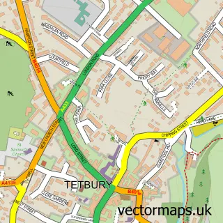
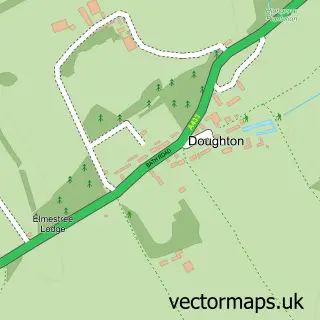
This Chavenage street map is a detailed vector street map covering a 750m x 750m area. Select a larger area to create and download your own vector street map of Chavenage.
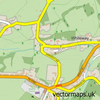
The 750-metre map sample for Chavenage covers 30 mapped buildings and approximately 3.7 km of road detail. The immediate area includes 3 MOT stations within 2 miles. The wider area around Chavenage features 1 tourism point of interest. To create a larger or custom map of Chavenage, the map builder lets you define your own coverage area and download editable SVG, PDF and PNG files.
Create a larger editable map of Chavenage
Choose any area you need and generate a high-quality vector map instantly. Perfect for print, planning, design, business and personal use.

This Chavenage street map in Gloucestershire is available as downloadable SVG, PDF and PNG map files, or as a printed map for planning, business, display, education, local information and design work. You can also create a larger custom map area using the map selector.
What this Chavenage map sample shows
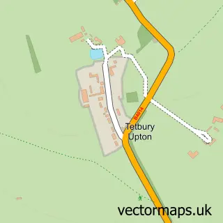
Chavenage lies within Tetbury Upton Cp parish, part of Tetbury With Upton ward in the Cotswold District local authority area. The postcode geography for this area includes the GL postcode area, the GL8 postcode district and the GL8 8 postcode sector. Residents fall under the Nhs Gloucestershire Integrated Care Board for NHS services.
Local features near Chavenage
Within 2 milesAmenities and services in and around Chavenage.
Administrative and postcode information for Chavenage
The local authority covering Chavenage is Cotswold District, within the county of Gloucestershire. The settlement lies within Tetbury With Upton ward and Tetbury Upton Cp civil parish. The GL8 postcode district and GL8 8 postcode sector serve the immediate area. NHS provision in the area is delivered through Gloucestershire Hospitals Nhs Foundation Trust.
Nearby street map samples around Chavenage

More street maps in Gloucestershire
750 metre map area coverage
Boundary, postcode and point of interest information for the 750m x 750m rectangle centred on this sample map.
Boundaries containing map centre
Constituency: South Cotswolds Co Const
County: Gloucestershire County
District: Cotswold District
Icb: NHS Gloucestershire ICB
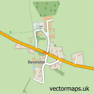
Parish: Beverston CP
Police Force: gloucestershire
Postcode District: GL8
Postcode Sector: GL8 8
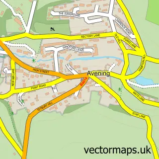
Ward: Grumbolds Ash with Avening Ward
Nearby boundaries intersecting sample
Parish: Tetbury Upton CP
Ward: Tetbury with Upton Ward
Postcode coverage
POI category counts
Active Life: 1
Business Consulting: 1
Business Manufacturing And Supply: 1
Car Dealer: 1
Flowers And Gifts Shop: 1
Food Beverage Service Distribution: 1
Landmark And Historical Building: 1
Sports And Recreation Venue: 1
Sample points of interest
- Chavenage Challenges
- Surevine
- Wildlife World
- Polaris Stroud
- The Wildlife Community
- Sally Armstrong
- Chavenage House
- Chavenage Challenges
Create a larger editable map of Chavenage
This sample shows only a 750 metre area. To create a larger map of Chavenage, use our map builder to choose your own coverage area, add titles and download editable SVG, PDF and PNG files.
Create a custom map of Chavenage