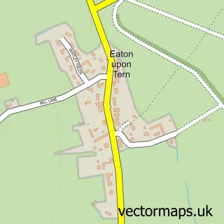
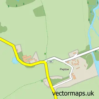
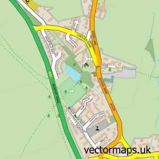
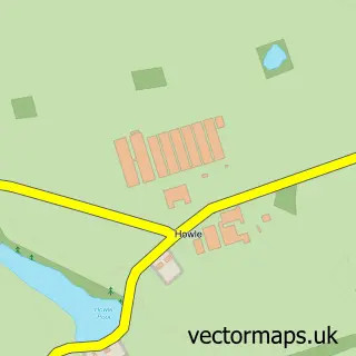
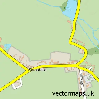
This Child's Ercall street map is a detailed vector street map covering a 750m x 750m area. Select a larger area to create and download your own vector street map of Child's Ercall.
The 750-metre map sample for Child's Ercall covers 185 mapped buildings and approximately 10.9 km of road detail, of which 12 named roads are named. The immediate area includes 1 MOT station within 2 miles. To create a larger or custom map of Child's Ercall, the map builder lets you define your own coverage area and download editable SVG, PDF and PNG files.
Create a larger editable map of Child's Ercall
Choose any area you need and generate a high-quality vector map instantly. Perfect for print, planning, design, business and personal use.

This Child's Ercall street map in Shropshire is available as downloadable SVG, PDF and PNG map files, or as a printed map for planning, business, display, education, local information and design work. You can also create a larger custom map area using the map selector.
What this Child's Ercall map sample shows
Child's Ercall lies within Child's Ercall Cp parish, part of Cheswardine ward in the Shropshire local authority area. The postcode geography for this area includes the TF postcode area, the TF9 postcode district and the TF9 2 postcode sector. Residents fall under the Nhs Shropshire, Telford And Wrekin Integrated Care Board for NHS services.
Local features near Child's Ercall
Within 2 milesAmenities and services in and around Child's Ercall.
Administrative and postcode information for Child's Ercall
Child's Ercall lies within Child's Ercall Cp parish, part of Cheswardine ward in the Shropshire local authority area. The postcode geography for this area includes the TF postcode area, the TF9 postcode district and the TF9 2 postcode sector. Residents fall under the Nhs Shropshire, Telford And Wrekin Integrated Care Board for NHS services.
Nearby street map samples around Child's Ercall

More street maps in Shropshire
750 metre map area coverage
Boundary, postcode and point of interest information for the 750m x 750m rectangle centred on this sample map.
Boundaries containing map centre
Constituency: The Wrekin Co Const
District: Shropshire
Icb: NHS Shropshire Telford and Wrekin ICB
Parish: Child's Ercall CP
Police Force: west mercia
Postcode District: TF9
Postcode Sector: TF9 2
Nearby boundaries intersecting sample
No additional intersecting boundaries found.
Postcode coverage
POI category counts
Toy Store: 2
Anglican Church: 1
Automotive Repair: 1
Business: 1
Construction Services: 1
Contractor: 1
Garbage Collection Service: 1
Gardener: 1
Home Security: 1
Retail: 1
Sample points of interest
- Childs Ercall St Michael & All Angels
- Salop restorations
- AACS
- Midland Garage Conversions
- CST Groundworks
- JP Skips
- Greenthumb Lawn Treatment Services
- Advanced Anti Crime Solutions
- JDE Steelwork Solutions
- Childs Ercall Club
- Kids Ride On Toys
- Ride on Toys
Create a larger editable map of Child's Ercall
This sample shows only a 750 metre area. To create a larger map of Child's Ercall, use our map builder to choose your own coverage area, add titles and download editable SVG, PDF and PNG files.
Create a custom map of Child's Ercall