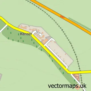
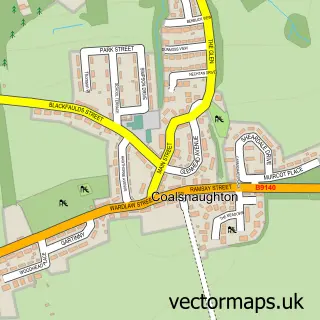
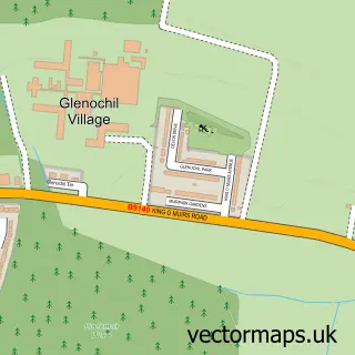
This Clackmannan street map is a detailed vector street map covering a 750m x 750m area. Select a larger area to create and download your own vector street map of Clackmannan.
The 750-metre map sample for Clackmannan covers 419 mapped buildings and approximately 16.0 km of road detail, of which 37 named roads are named. The immediate area includes 1 GP surgery, with 3 within 2 miles, 1 pub and 7 MOT stations within 2 miles. The wider area around Clackmannan features 3 tourism points of interest and 1 food and drink venue. To create a larger or custom map of Clackmannan, the map builder lets you define your own coverage area and download editable SVG, PDF and PNG files.
Create a larger editable map of Clackmannan
Choose any area you need and generate a high-quality vector map instantly. Perfect for print, planning, design, business and personal use.

This Clackmannan street map in Clackmannan is available as downloadable SVG, PDF and PNG map files, or as a printed map for planning, business, display, education, local information and design work. You can also create a larger custom map area using the map selector.
What this Clackmannan map sample shows
Clackmannan lies within Clackmannanshire parish, part of Clackmannanshire East ward in the Clackmannanshire local authority area. The postcode geography for this area includes the FK postcode area, the FK10 postcode district and the FK10 4 postcode sector. Residents fall under the Forth Valley for NHS services.
Local features near Clackmannan
Within 2 milesAmenities and services in and around Clackmannan.
Administrative and postcode information for Clackmannan
The local authority covering Clackmannan is Clackmannanshire, within the county of Clackmannan. The settlement lies within Clackmannanshire East ward and Clackmannanshire civil parish. The FK10 postcode district and FK10 4 postcode sector serve the immediate area. NHS provision in the area is delivered through Forth Valley.
Nearby street map samples around Clackmannan

More street maps in Clackmannan
750 metre map area coverage
Boundary, postcode and point of interest information for the 750m x 750m rectangle centred on this sample map.
Boundaries containing map centre
Constituency: Alloa and Grangemouth Co Const
District: Clackmannanshire
Icb: Forth Valley
Postcode District: FK10
Postcode Sector: FK10 4
Ward: Clackmannanshire East Ward
Nearby boundaries intersecting sample
No additional intersecting boundaries found.
Postcode coverage
POI category counts
Convenience Store: 4
Park: 3
Pharmacy: 3
Bakery: 2
Beauty Salon: 2
Doctor: 2
Dog Walkers: 2
Fish And Chips Restaurant: 2
Topic Concert Venue: 2
Atms: 1
Sample points of interest
- The Cooperative Food (BF) Clackmannan
- Allys Auto Clean
- JR Auto Welding & Repairs
- Thistle Do Icely
- Toni's Bakery
- The County Bar
- Samantha Blues Colour Expert
- The Nail Natter
- Amber Gas Group
- Stonetext
- Wallace Joinery Services
- Clackmannan
Create a larger editable map of Clackmannan
This sample shows only a 750 metre area. To create a larger map of Clackmannan, use our map builder to choose your own coverage area, add titles and download editable SVG, PDF and PNG files.
Create a custom map of Clackmannan