Vector Maps logo
Home Why it works Popular maps Districts Samples Customizer Create Your Map
VectorMaps.uk
Home Popular maps Districts Samples Customizer Create Your Map Privacy Disclaimer
Home / UK Maps / Clackmannan / Kennet Map

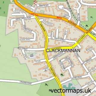
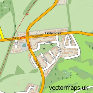
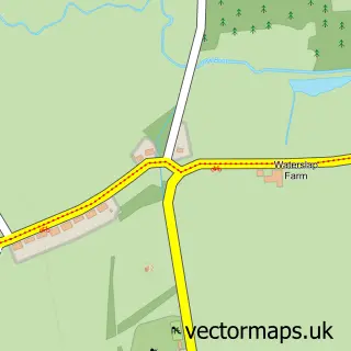
This Kennet street map is a detailed vector street map covering a 750m x 750m area. Select a larger area to create and download your own vector street map of Kennet.

Kennet is a village in Clackmannan, in the Mid Scotland And Fife of Scotland. Historically, the area formed part of Clackmannanshire. The settlement falls within the Ochil And South Perthshire parliamentary constituency. It is served by the FK10 postcode

The 750-metre map sample for Kennet covers 36 mapped buildings and approximately 6.3 km of road detail, of which 2 named roads are named. The immediate area includes 1 GP surgery within 2 miles and 1 MOT station. To create a larger or custom map of Kennet, the map builder lets you define your own coverage area and download editable SVG, PDF and PNG files.

36Buildings
6.34 kmRoads
2Named roads
0Residents within 2 miles
Create your own

Create a larger editable map of Kennet

Choose any area you need and generate a high-quality vector map instantly. Perfect for print, planning, design, business and personal use.

Choose any location
Editable SVG files
Any size up to A0
PDF, PNG & more
Instant download
High quality guaranteed
Create My Custom Map
Secure, private & no credit card required
Kennet Vector Street Map
750m Sample
Kennet vector street map sample showing roads, buildings and local features in a 750 metre preview area
Buy Kennet Map Print from £12.95 Buy Kennet Digital Map from £6

This Kennet street map in Clackmannan is available as downloadable SVG, PDF and PNG map files, or as a printed map for planning, business, display, education, local information and design work. You can also create a larger custom map area using the map selector.

What this Kennet map sample shows

Kennet lies within Clackmannanshire parish, part of Clackmannanshire East ward in the Clackmannanshire local authority area. The postcode geography for this area includes the FK postcode area, the FK10 postcode district and the FK10 4 postcode sector. Residents fall under the Forth Valley for NHS services.

Local features near Kennet

Within 2 miles

Amenities and services in and around Kennet.

1 GP surgeries within 2 miles
1 MOT stations 1 within 2 miles
2 Vehicle services

Counts are approximate and based on publicly available data.

Administrative and postcode information for Kennet

Kennet lies within Clackmannanshire parish, part of Clackmannanshire East ward in the Clackmannanshire local authority area. The postcode geography for this area includes the FK postcode area, the FK10 postcode district and the FK10 4 postcode sector. Residents fall under the Forth Valley for NHS services.

Parish CLACKMANNANSHIRE
Ward Clackmannanshire East
District / local authority Clackmannanshire
County Clackmannan
Historic county Clackmannanshire
Postcode district FK10
Postcode sector FK10 4
Parliamentary constituency Ochil and South Perthshire
Region Mid Scotland and Fife
Country Scotland

Nearby street map samples around Kennet

Street map sample of Clackmannan, Clackmannan Clackmannan Town - Clackmannan - 1.1 miles Street map sample of Stirling, Stirling and Falkirk Stirling City - Stirling and Falkirk - 8.1 miles Street map sample of Airth, Stirling and Falkirk Airth Village - Stirling and Falkirk - 2.7 miles Street map sample of Sauchie, Clackmannan Sauchie Village - Clackmannan - 2.8 miles Street map sample of Coalsnaughton, Clackmannan Coalsnaughton Village - Clackmannan - 3.0 miles Street map sample of Fishcross, Clackmannan Fishcross Village - Clackmannan - 3.0 miles Street map sample of South Alloa, Stirling and Falkirk South Alloa Village - Stirling and Falkirk - 3.2 miles Street map sample of Devonside, Clackmannan Devonside Village - Clackmannan - 3.3 miles Street map sample of Benview, Clackmannan Benview Village - Clackmannan - 3.3 miles Street map sample of Letham, Stirling and Falkirk Letham Village - Stirling and Falkirk - 3.5 miles

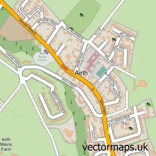
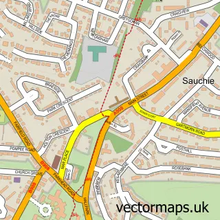
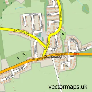
More street maps in Clackmannan

Street map sample of Clackmannan, Clackmannan Clackmannan Town - 1.1 miles Street map sample of Alloa, Clackmannan Alloa Town - 2.7 miles Street map sample of Sauchie, Clackmannan Sauchie Village - 2.8 miles Street map sample of Coalsnaughton, Clackmannan Coalsnaughton Village - 3.0 miles Street map sample of Fishcross, Clackmannan Fishcross Village - 3.0 miles

750 metre map area coverage

Boundary, postcode and point of interest information for the 750m x 750m rectangle centred on this sample map.

Boundaries containing map centre

Constituency: Alloa and Grangemouth Co Const

District: Clackmannanshire

Icb: Forth Valley

Postcode District: FK10

Postcode Sector: FK10 4

Ward: Clackmannanshire East Ward

Nearby boundaries intersecting sample

Constituency: Dunfermline and Dollar Co Const

Postcode coverage

FK10 FK10 4

POI category counts

Automotive Repair: 2

Auto Body Shop: 1

Carpenter: 1

Used Car Dealer: 1

Sample points of interest

  • Foz Sports Bodyshop Auto Body Shop
  • Foz Sports Alloys Automotive Repair
  • Foz Sports Bodyshop Automotive Repair
  • Angus Turner Carpenter
  • R K Car Sales Used Car Dealer

Create a larger editable map of Kennet

This sample shows only a 750 metre area. To create a larger map of Kennet, use our map builder to choose your own coverage area, add titles and download editable SVG, PDF and PNG files.

Create a custom map of Kennet

Phone 01751 473136 | Copyright Vectormaps.uk 2026

Samples Customizer Privacy Disclaimer
Kennet Vector Street Map
Kennet enlarged street map sample showing a 750 metre preview area