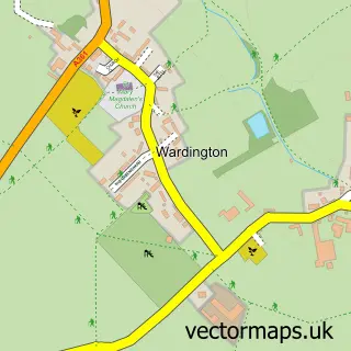
This Claydon street map is a detailed vector street map covering a 750m x 750m area. Select a larger area to create and download your own vector street map of Claydon.
The 750-metre map sample for Claydon covers 125 mapped buildings and approximately 29.3 km of road detail, of which 8 named roads are named. The wider area around Claydon features 1 tourism point of interest. To create a larger or custom map of Claydon, the map builder lets you define your own coverage area and download editable SVG, PDF and PNG files.
Create a larger editable map of Claydon
Choose any area you need and generate a high-quality vector map instantly. Perfect for print, planning, design, business and personal use.

This Claydon street map in Oxfordshire is available as downloadable SVG, PDF and PNG map files, or as a printed map for planning, business, display, education, local information and design work. You can also create a larger custom map area using the map selector.
What this Claydon map sample shows
Claydon lies within Claydon With Clattercot Cp parish, part of Cropredy, Sibfords And Wroxton ward in the Cherwell District local authority area. The postcode geography for this area includes the OX postcode area, the OX17 postcode district and the OX17 1 postcode sector. Residents fall under the Nhs Buckinghamshire, Oxfordshire And Berkshire West Integrated Care Board for NHS services.
Local features near Claydon
Within 2 milesAmenities and services in and around Claydon.
Administrative and postcode information for Claydon
Claydon lies within Claydon With Clattercot Cp parish, part of Cropredy, Sibfords And Wroxton ward in the Cherwell District local authority area. The postcode geography for this area includes the OX postcode area, the OX17 postcode district and the OX17 1 postcode sector. Residents fall under the Nhs Buckinghamshire, Oxfordshire And Berkshire West Integrated Care Board for NHS services.
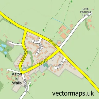
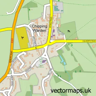
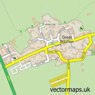
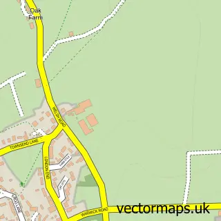
Nearby street map samples around Claydon


More street maps in Oxfordshire
750 metre map area coverage
Boundary, postcode and point of interest information for the 750m x 750m rectangle centred on this sample map.
Boundaries containing map centre
Constituency: Banbury Co Const
County: Oxfordshire County
District: Cherwell District
Icb: NHS Thames Valley ICB
Parish: Claydon with Clattercot CP
Police Force: thames valley
Postcode District: OX17
Postcode Sector: OX17 1
Ward: Cropredy, Sibfords & Wroxton Ward
Nearby boundaries intersecting sample
No additional intersecting boundaries found.
Postcode coverage
POI category counts
Anglican Church: 1
Cottage: 1
Electrician: 1
Event Technology Service: 1
Landmark And Historical Building: 1
Transportation: 1
Womens Clothing Store: 1
Sample points of interest
- Claydon: St James the Great
- Priors End Holiday Cottage
- MJB Electrical Contractors Ltd
- New Folium Marquees
- Claydon, Oxfordshire
- Cherwell Fire Safety
- Hat Boutique - Claydon, Nr Banbury
Create a larger editable map of Claydon
This sample shows only a 750 metre area. To create a larger map of Claydon, use our map builder to choose your own coverage area, add titles and download editable SVG, PDF and PNG files.
Create a custom map of Claydon