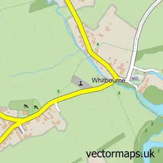
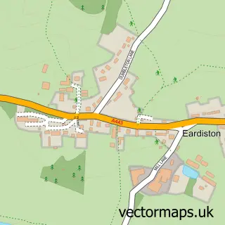
This Clifton upon Teme street map is a detailed vector street map covering a 750m x 750m area. Select a larger area to create and download your own vector street map of Clifton upon Teme.
The 750-metre map sample for Clifton upon Teme covers 262 mapped buildings and approximately 27.2 km of road detail, of which 11 named roads are named. The immediate area includes 1 school, 2 pubs and 1 MOT station. The wider area around Clifton upon Teme features 2 food and drink venues. To create a larger or custom map of Clifton upon Teme, the map builder lets you define your own coverage area and download editable SVG, PDF and PNG files.
Create a larger editable map of Clifton upon Teme
Choose any area you need and generate a high-quality vector map instantly. Perfect for print, planning, design, business and personal use.

This Clifton upon Teme street map in Worcestershire is available as downloadable SVG, PDF and PNG map files, or as a printed map for planning, business, display, education, local information and design work. You can also create a larger custom map area using the map selector.
What this Clifton upon Teme map sample shows
Clifton upon Teme lies within Clifton Upon Teme Cp parish, part of Teme Valley ward in the Malvern Hills District local authority area. The postcode geography for this area includes the WR postcode area, the WR6 postcode district and the WR6 6 postcode sector. Residents fall under the Nhs Herefordshire And Worcestershire Integrated Care Board for NHS services.
Local features near Clifton upon Teme
Within 2 milesAmenities and services in and around Clifton upon Teme.
Administrative and postcode information for Clifton upon Teme
Clifton upon Teme lies within Clifton Upon Teme Cp parish, part of Teme Valley ward in the Malvern Hills District local authority area. The postcode geography for this area includes the WR postcode area, the WR6 postcode district and the WR6 6 postcode sector. Residents fall under the Nhs Herefordshire And Worcestershire Integrated Care Board for NHS services.
Nearby street map samples around Clifton upon Teme

More street maps in Worcestershire
750 metre map area coverage
Boundary, postcode and point of interest information for the 750m x 750m rectangle centred on this sample map.
Boundaries containing map centre
Constituency: West Worcestershire Co Const
County: Worcestershire County
District: Malvern Hills District
Icb: NHS Herefordshire and Worcestershire ICB
Parish: Clifton upon Teme CP
Police Force: west mercia
Postcode District: WR6
Postcode Sector: WR6 6
Ward: Baldwin Ward
Nearby boundaries intersecting sample
Parish: Lower Sapey CP
Postcode coverage
POI category counts
Automotive Repair: 2
Contractor: 2
Pub: 2
Scout Hall: 2
Shipping Center: 2
Anglican Church: 1
Building Contractor: 1
Business: 1
Chimney Sweep: 1
Church Cathedral: 1
Sample points of interest
- St Kenelm's
- Horton Motor Services
- Yeomans Garage
- Skellerns Doors & Windows
- NDS Engineering
- Daniel Jones Chimney Sweep Services
- St Kenelms Church, Church Road,clifton Upon Teme
- Taylors Conservatory Care
- WP Builders Worcester
- Village Store
- The Dust Fairy
- Hereford Sectional Buildings
Create a larger editable map of Clifton upon Teme
This sample shows only a 750 metre area. To create a larger map of Clifton upon Teme, use our map builder to choose your own coverage area, add titles and download editable SVG, PDF and PNG files.
Create a custom map of Clifton upon Teme