Vector Maps logo
Home Why it works Popular maps Districts Samples Customizer Create Your Map
VectorMaps.uk
Home Popular maps Districts Samples Customizer Create Your Map Privacy Disclaimer
Home / UK Maps / Argyll and Bute / Colintraive Map

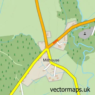
This Colintraive street map is a detailed vector street map covering a 750m x 750m area. Select a larger area to create and download your own vector street map of Colintraive.

Colintraive is a village in Argyll And Bute, in the Highlands And Islands of Scotland. Historically, the area formed part of Argyllshire. The settlement falls within the Argyll And Bute parliamentary constituency. It is served by the PA22 postcode distric

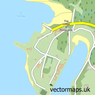
The 750-metre map sample for Colintraive covers 37 mapped buildings and approximately 6.9 km of road detail. The wider area around Colintraive features 2 hotels. To create a larger or custom map of Colintraive, the map builder lets you define your own coverage area and download editable SVG, PDF and PNG files.

37Buildings
6.87 kmRoads
0Named roads
0Residents within 2 miles
Create your own

Create a larger editable map of Colintraive

Choose any area you need and generate a high-quality vector map instantly. Perfect for print, planning, design, business and personal use.

Choose any location
Editable SVG files
Any size up to A0
PDF, PNG & more
Instant download
High quality guaranteed
Create My Custom Map
Secure, private & no credit card required
Colintraive Vector Street Map
750m Sample
Colintraive vector street map sample showing roads, buildings and local features in a 750 metre preview area
Buy Colintraive Map Print from £12.95 Buy Colintraive Digital Map from £6

This Colintraive street map in Argyll and Bute is available as downloadable SVG, PDF and PNG map files, or as a printed map for planning, business, display, education, local information and design work. You can also create a larger custom map area using the map selector.

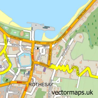
What this Colintraive map sample shows

Colintraive lies within Argyll And Bute parish, part of Cowal ward in the Argyll And Bute local authority area. The postcode geography for this area includes the PA postcode area, the PA22 postcode district and the PA22 3 postcode sector. Local NHS services are provided through Highland.

Local features near Colintraive

Within 2 miles

Amenities and services in and around Colintraive.

2 Hotels

Counts are approximate and based on publicly available data.

Administrative and postcode information for Colintraive

The local authority covering Colintraive is Argyll And Bute, within the county of Argyll And Bute. The settlement lies within Cowal ward and Argyll And Bute civil parish. The PA22 postcode district and PA22 3 postcode sector serve the immediate area. NHS provision in the area is delivered through Highland.

Parish ARGYLL AND BUTE
Ward Cowal
District / local authority Argyll and Bute
County Argyll and Bute
Historic county Argyllshire
Postcode district PA22
Postcode sector PA22 3
Parliamentary constituency Argyll and Bute
Region Highlands and Islands
Country Scotland

Nearby street map samples around Colintraive

Street map sample of Rothesay, Argyll and Bute Rothesay Town - Argyll and Bute - 7.1 miles Street map sample of Glasgow, City of Glasgow Glasgow City - City of Glasgow - 35.2 miles Street map sample of Tighnabruaich, Argyll and Bute Tighnabruaich Village - Argyll and Bute - 3.7 miles Street map sample of Kames, Argyll and Bute Kames Village - Argyll and Bute - 4.2 miles Street map sample of Port Bannatyne, Argyll and Bute Port Bannatyne Village - Argyll and Bute - 5.1 miles Street map sample of Millhouse, Argyll and Bute Millhouse Village - Argyll and Bute - 5.3 miles Street map sample of Ardbeg, Argyll and Bute Ardbeg Village - Argyll and Bute - 5.8 miles Street map sample of Clachan of Glendaruel, Argyll and Bute Clachan of Glendaruel Village - Argyll and Bute - 6.4 miles Street map sample of Kilfinan, Argyll and Bute Kilfinan Village - Argyll and Bute - 6.6 miles Street map sample of Portavadie, Argyll and Bute Portavadie Village - Argyll and Bute - 7.2 miles

More street maps in Argyll and Bute

Street map sample of Tighnabruaich, Argyll and Bute Tighnabruaich Village - 3.7 miles Street map sample of Kames, Argyll and Bute Kames Village - 4.2 miles Street map sample of Port Bannatyne, Argyll and Bute Port Bannatyne Village - 5.1 miles Street map sample of Millhouse, Argyll and Bute Millhouse Village - 5.3 miles Street map sample of Ardbeg, Argyll and Bute Ardbeg Village - 5.8 miles

750 metre map area coverage

Boundary, postcode and point of interest information for the 750m x 750m rectangle centred on this sample map.

Boundaries containing map centre

Constituency: Argyll, Bute and South Lochaber Co Const

District: Argyll and Bute

Icb: Highland

Postcode District: PA22

Postcode Sector: PA22 3

Ward: Cowal Ward

Nearby boundaries intersecting sample

No additional intersecting boundaries found.

Postcode coverage

PA22 PA22 3

POI category counts

Hotel: 2

Ev Charging Station: 1

Ferry Boat Company: 1

Professional Services: 1

Shipping Center: 1

Transportation: 1

Sample points of interest

  • Colintraive Village Hall Ev Charging Station
  • Caledonian MacBrayne | Colintraive Ferry Boat Company
  • Eilean Dhu - Luxury Scottish Stay Hotel
  • The Colintraive Hotel Hotel
  • Caledonian MacBrayne Professional Services
  • Colintraive Post Office Shipping Center
  • Colintraive Ferry Terminal Transportation

Create a larger editable map of Colintraive

This sample shows only a 750 metre area. To create a larger map of Colintraive, use our map builder to choose your own coverage area, add titles and download editable SVG, PDF and PNG files.

Create a custom map of Colintraive

Phone 01751 473136 | Copyright Vectormaps.uk 2026

Samples Customizer Privacy Disclaimer
Colintraive Vector Street Map
Colintraive enlarged street map sample showing a 750 metre preview area