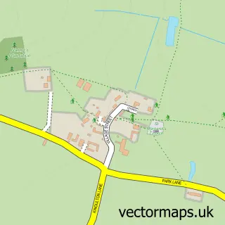
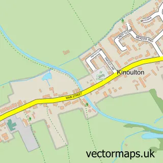
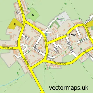
This Colston Bassett street map is a detailed vector street map covering a 750m x 750m area. Select a larger area to create and download your own vector street map of Colston Bassett.
The 750-metre map sample for Colston Bassett covers 88 mapped buildings and approximately 15.1 km of road detail, of which 8 named roads are named. The immediate area includes 1 school, 1 GP surgery within 2 miles, 1 pub and 1 MOT station within 2 miles. The wider area around Colston Bassett features 1 food and drink venue. To create a larger or custom map of Colston Bassett, the map builder lets you define your own coverage area and download editable SVG, PDF and PNG files.
Create a larger editable map of Colston Bassett
Choose any area you need and generate a high-quality vector map instantly. Perfect for print, planning, design, business and personal use.

This Colston Bassett street map in Nottinghamshire is available as downloadable SVG, PDF and PNG map files, or as a printed map for planning, business, display, education, local information and design work. You can also create a larger custom map area using the map selector.
What this Colston Bassett map sample shows
Colston Bassett lies within Colston Bassett Cp parish, part of Nevile & Langar ward in the Rushcliffe District (B) local authority area. The postcode geography for this area includes the NG postcode area, the NG12 postcode district and the NG12 3 postcode sector. Residents fall under the Nhs Nottingham And Nottinghamshire Integrated Care Board for NHS services.
Local features near Colston Bassett
Within 2 milesAmenities and services in and around Colston Bassett.
Administrative and postcode information for Colston Bassett
Colston Bassett lies within Colston Bassett Cp parish, part of Nevile & Langar ward in the Rushcliffe District (B) local authority area. The postcode geography for this area includes the NG postcode area, the NG12 postcode district and the NG12 3 postcode sector. Residents fall under the Nhs Nottingham And Nottinghamshire Integrated Care Board for NHS services.
Nearby street map samples around Colston Bassett

More street maps in Nottinghamshire
750 metre map area coverage
Boundary, postcode and point of interest information for the 750m x 750m rectangle centred on this sample map.
Boundaries containing map centre
Constituency: Rushcliffe Co Const
County: Nottinghamshire County
District: Rushcliffe District (B)
Icb: NHS Nottingham and Nottinghamshire ICB
Parish: Colston Bassett CP
Police Force: nottinghamshire
Postcode District: NG12
Postcode Sector: NG12 3
Ward: Nevile & Langar Ward
Nearby boundaries intersecting sample
No additional intersecting boundaries found.
Postcode coverage
POI category counts
Anglican Church: 1
Automotive Repair: 1
Business Manufacturing And Supply: 1
Car Dealer: 1
Church Cathedral: 1
Elementary School: 1
Gastropub: 1
Home Developer: 1
Martial Arts Club: 1
Photography Store And Services: 1
Sample points of interest
- St John the Divine, Colston Bassett
- PD PARTS - Clapped Motorsport - Diesel Tuning and Performance
- Colston Bassett Dairy
- Jackson and How
- St John's Church
- Colston Bassett School
- Martins Arms
- Extrarooms
- Colston Bassett Shotokan Karate Club
- John McLean Photography
- The Martins Arms
- Colston Bassett Cricket Field
Create a larger editable map of Colston Bassett
This sample shows only a 750 metre area. To create a larger map of Colston Bassett, use our map builder to choose your own coverage area, add titles and download editable SVG, PDF and PNG files.
Create a custom map of Colston Bassett