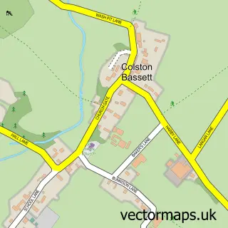
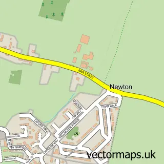
This Cropwell Butler street map is a detailed vector street map covering a 750m x 750m area. Select a larger area to create and download your own vector street map of Cropwell Butler.
The 750-metre map sample for Cropwell Butler covers 180 mapped buildings and approximately 13.7 km of road detail, of which 14 named roads are named. The immediate area includes 1 GP surgery within 2 miles, 2 pubs and 2 MOT stations within 2 miles. The wider area around Cropwell Butler features 2 tourism points of interest and 2 food and drink venues. To create a larger or custom map of Cropwell Butler, the map builder lets you define your own coverage area and download editable SVG, PDF and PNG files.
Create a larger editable map of Cropwell Butler
Choose any area you need and generate a high-quality vector map instantly. Perfect for print, planning, design, business and personal use.

This Cropwell Butler street map in Nottinghamshire is available as downloadable SVG, PDF and PNG map files, or as a printed map for planning, business, display, education, local information and design work. You can also create a larger custom map area using the map selector.
What this Cropwell Butler map sample shows
Cropwell Butler lies within Cropwell Butler Cp parish, part of Cropwell ward in the Rushcliffe District (B) local authority area. The postcode geography for this area includes the NG postcode area, the NG12 postcode district and the NG12 3 postcode sector. Residents fall under the Nhs Nottingham And Nottinghamshire Integrated Care Board for NHS services.
Local features near Cropwell Butler
Within 2 milesAmenities and services in and around Cropwell Butler.
Administrative and postcode information for Cropwell Butler
The local authority covering Cropwell Butler is Rushcliffe District (B), within the county of Nottinghamshire. The settlement lies within Cropwell ward and Cropwell Butler Cp civil parish. The NG12 postcode district and NG12 3 postcode sector serve the immediate area. NHS provision in the area is delivered through Nottingham University Hospitals Nhs Trust.
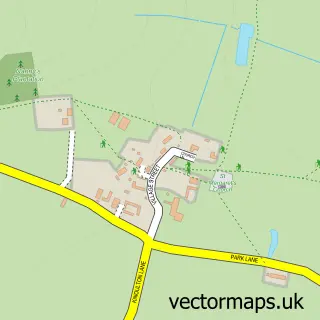
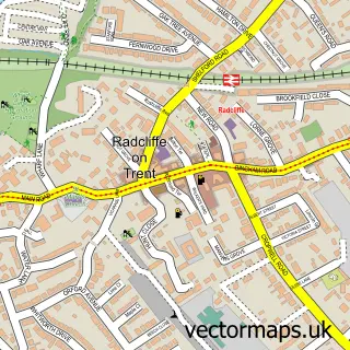
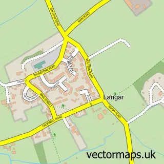
Nearby street map samples around Cropwell Butler

More street maps in Nottinghamshire
750 metre map area coverage
Boundary, postcode and point of interest information for the 750m x 750m rectangle centred on this sample map.
Boundaries containing map centre
Constituency: Rushcliffe Co Const
County: Nottinghamshire County
District: Rushcliffe District (B)
Icb: NHS Nottingham and Nottinghamshire ICB
Parish: Cropwell Butler CP
Police Force: nottinghamshire
Postcode District: NG12
Postcode Sector: NG12 3
Ward: Cropwell Ward
Nearby boundaries intersecting sample
No additional intersecting boundaries found.
Postcode coverage
POI category counts
Attractions And Activities: 2
Furniture Store: 2
Pub: 2
Sports Club And League: 2
Beauty Product Supplier: 1
Community Center: 1
Courier And Delivery Services: 1
Human Resource Services: 1
Kids Recreation And Party: 1
Topic Concert Venue: 1
Sample points of interest
- Olivia’s Bench
- Sheldon Field
- Altered Image
- Cropwell Butler Village Hall
- At Your Service
- Barratt And Swann Bespoke Kitchens And Bedrooms
- Barratt and Swann
- Alicia Kite Academy
- Belvoir Bouncy Castles
- Plough Inn
- The Plough Inn
- Cropwell Cricket Club
Create a larger editable map of Cropwell Butler
This sample shows only a 750 metre area. To create a larger map of Cropwell Butler, use our map builder to choose your own coverage area, add titles and download editable SVG, PDF and PNG files.
Create a custom map of Cropwell Butler