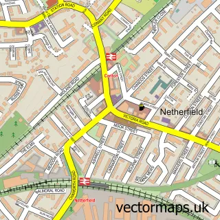
This Harlequin street map is a detailed vector street map covering a 750m x 750m area. Select a larger area to create and download your own vector street map of Harlequin.
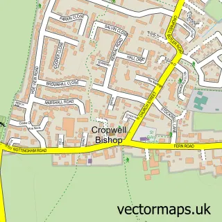
The 750-metre map sample for Harlequin covers 344 mapped buildings and approximately 15.6 km of road detail, of which 24 named roads are named. The immediate area includes 1 GP surgery within 2 miles and 1 MOT station within 2 miles. The wider area around Harlequin features 1 campsite within 2 miles. To create a larger or custom map of Harlequin, the map builder lets you define your own coverage area and download editable SVG, PDF and PNG files.
Create a larger editable map of Harlequin
Choose any area you need and generate a high-quality vector map instantly. Perfect for print, planning, design, business and personal use.

This Harlequin street map in Nottinghamshire is available as downloadable SVG, PDF and PNG map files, or as a printed map for planning, business, display, education, local information and design work. You can also create a larger custom map area using the map selector.
What this Harlequin map sample shows
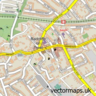
Harlequin lies within Radcliffe On Trent Cp parish, part of Radcliffe On Trent ward in the Rushcliffe District (B) local authority area. The postcode geography for this area includes the NG postcode area, the NG12 postcode district and the NG12 2 postcode sector. Residents fall under the Nhs Nottingham And Nottinghamshire Integrated Care Board for NHS services.
Local features near Harlequin
Within 2 milesAmenities and services in and around Harlequin.
Administrative and postcode information for Harlequin
Harlequin lies within Radcliffe On Trent Cp parish, part of Radcliffe On Trent ward in the Rushcliffe District (B) local authority area. The postcode geography for this area includes the NG postcode area, the NG12 postcode district and the NG12 2 postcode sector. Residents fall under the Nhs Nottingham And Nottinghamshire Integrated Care Board for NHS services.
Nearby street map samples around Harlequin

More street maps in Nottinghamshire
750 metre map area coverage
Boundary, postcode and point of interest information for the 750m x 750m rectangle centred on this sample map.
Boundaries containing map centre
Constituency: Rushcliffe Co Const
County: Nottinghamshire County
District: Rushcliffe District (B)
Icb: NHS Nottingham and Nottinghamshire ICB
Parish: Radcliffe on Trent CP
Police Force: nottinghamshire
Postcode District: NG12
Postcode Sector: NG12 2
Ward: Radcliffe on Trent Ward
Nearby boundaries intersecting sample
Postcode Sector: NG12 1
Postcode coverage
POI category counts
Convenience Store: 3
Beauty Salon: 2
Chiropractor: 2
Home Developer: 2
Plumbing: 2
Active Life: 1
Advertising Agency: 1
Books Mags Music And Video: 1
Carpet Store: 1
Computer Store: 1
Sample points of interest
- Bingham Road Playing Fields
- Simple Marketing Consultancy
- Clare Hair
- Helen Sutcliffe Mobile Wedding Hairstylist
- Troy Jenkinson
- County Floor Heating Systems
- Radcliffe Chiropractic Clinic
- Radcliffe Chiropractic Clinic
- The Mac & PC Workshop Nottingham
- HTC Construction Limited
- Costcutter
- Mace
Create a larger editable map of Harlequin
This sample shows only a 750 metre area. To create a larger map of Harlequin, use our map builder to choose your own coverage area, add titles and download editable SVG, PDF and PNG files.
Create a custom map of Harlequin