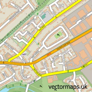
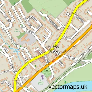
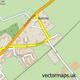
This Netherfield street map is a detailed vector street map covering a 750m x 750m area. Select a larger area to create and download your own vector street map of Netherfield.
The 750-metre map sample for Netherfield covers 500 mapped buildings and approximately 31.1 km of road detail, of which 64 named roads are named. The immediate area includes 2 schools, 2 railway stations, 1 GP surgery, with 7 within 2 miles and 4 pubs among other local services. The wider area around Netherfield features 1 tourism point of interest, 9 food and drink venues and 1 campsite within 2 miles. To create a larger or custom map of Netherfield, the map builder lets you define your own coverage area and download editable SVG, PDF and PNG files.
Create a larger editable map of Netherfield
Choose any area you need and generate a high-quality vector map instantly. Perfect for print, planning, design, business and personal use.

This Netherfield street map in Nottinghamshire is available as downloadable SVG, PDF and PNG map files, or as a printed map for planning, business, display, education, local information and design work. You can also create a larger custom map area using the map selector.
What this Netherfield map sample shows
Netherfield lies within Nottinghamshire County parish, part of Gedling ward in the Gedling District (B) local authority area. The postcode geography for this area includes the NG postcode area, the NG4 postcode district and the NG4 3 postcode sector. Residents fall under the Nhs Nottingham And Nottinghamshire Integrated Care Board for NHS services.
Local features near Netherfield
Within 2 milesAmenities and services in and around Netherfield.
Administrative and postcode information for Netherfield
The local authority covering Netherfield is Gedling District (B), within the county of Nottinghamshire. The settlement lies within Gedling ward and Nottinghamshire County civil parish. The NG4 postcode district and NG4 3 postcode sector serve the immediate area. NHS provision in the area is delivered through Nottingham University Hospitals Nhs Trust.
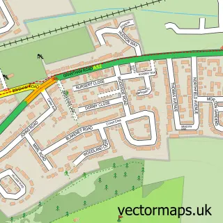
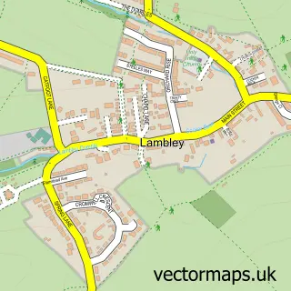
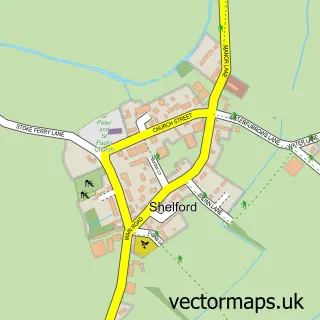
Nearby street map samples around Netherfield

More street maps in Nottinghamshire
750 metre map area coverage
Boundary, postcode and point of interest information for the 750m x 750m rectangle centred on this sample map.
Boundaries containing map centre
Constituency: Gedling Co Const
County: Nottinghamshire County
District: Gedling District (B)
Icb: NHS Nottingham and Nottinghamshire ICB
Police Force: nottinghamshire
Postcode District: NG4
Postcode Sector: NG4 2
Ward: Netherfield Ward
Nearby boundaries intersecting sample
Parish: Colwick CP
Postcode Sector: NG4 1, NG4 3
Ward: Carlton Ward, Colwick Ward
Postcode coverage
POI category counts
Automotive Repair: 8
Beauty Salon: 8
Building Supply Store: 5
Hair Salon: 5
Chinese Restaurant: 4
Doctor: 4
Event Planning: 4
Professional Services: 4
Pub: 4
Supermarket: 4
Sample points of interest
- Marshall Smalley Accountants Ltd.
- Respect for Animals
- Motif Creative
- The Media Lounge
- TomTom Advertising and Public Relations
- Goude Mind
- Netherfield: St George the Martyr
- As New
- Cherrywood Joinery Manufacturers
- Firefly Framing
- Kiddy Cook Nottingham Central
- Stuck in the Middle
Create a larger editable map of Netherfield
This sample shows only a 750 metre area. To create a larger map of Netherfield, use our map builder to choose your own coverage area, add titles and download editable SVG, PDF and PNG files.
Create a custom map of Netherfield