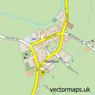
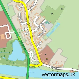
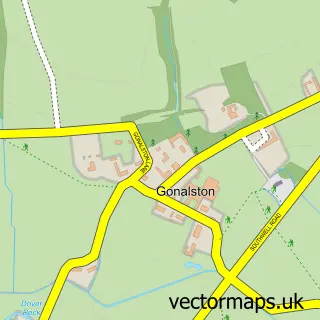
This Bulcote street map is a detailed vector street map covering a 750m x 750m area. Select a larger area to create and download your own vector street map of Bulcote.
The 750-metre map sample for Bulcote covers 146 mapped buildings and approximately 12.0 km of road detail, of which 9 named roads are named. The immediate area includes 1 GP surgery within 2 miles and 2 MOT stations within 2 miles. The wider area around Bulcote features 1 campsite within 2 miles. To create a larger or custom map of Bulcote, the map builder lets you define your own coverage area and download editable SVG, PDF and PNG files.
Create a larger editable map of Bulcote
Choose any area you need and generate a high-quality vector map instantly. Perfect for print, planning, design, business and personal use.

This Bulcote street map in Nottinghamshire is available as downloadable SVG, PDF and PNG map files, or as a printed map for planning, business, display, education, local information and design work. You can also create a larger custom map area using the map selector.
What this Bulcote map sample shows
Bulcote lies within Burton Joyce Cp parish, part of Trent Valley ward in the Gedling District (B) local authority area. The postcode geography for this area includes the NG postcode area, the NG14 postcode district and the NG14 5 postcode sector. Residents fall under the Nhs Nottingham And Nottinghamshire Integrated Care Board for NHS services.
Local features near Bulcote
Within 2 milesAmenities and services in and around Bulcote.
Administrative and postcode information for Bulcote
Bulcote lies within Burton Joyce Cp parish, part of Trent Valley ward in the Gedling District (B) local authority area. The postcode geography for this area includes the NG postcode area, the NG14 postcode district and the NG14 5 postcode sector. Residents fall under the Nhs Nottingham And Nottinghamshire Integrated Care Board for NHS services.
Nearby street map samples around Bulcote

More street maps in Nottinghamshire
750 metre map area coverage
Boundary, postcode and point of interest information for the 750m x 750m rectangle centred on this sample map.
Boundaries containing map centre
Constituency: Sherwood Forest Co Const
County: Nottinghamshire County
District: Newark and Sherwood District
Icb: NHS Nottingham and Nottinghamshire ICB
Parish: Bulcote CP
Police Force: nottinghamshire
Postcode District: NG14
Postcode Sector: NG14 5
Ward: Lowdham Ward
Nearby boundaries intersecting sample
Constituency: Gedling Co Const
District: Gedling District (B)
Parish: Burton Joyce CP
Ward: Trent Valley Ward
Postcode coverage
POI category counts
Architectural Designer: 1
Betting Center: 1
Church Cathedral: 1
Fire Department: 1
Landscaping: 1
Pet Groomer: 1
Pet Store: 1
Womens Clothing Store: 1
Sample points of interest
- Clark Architectural Services
- Coral
- Holy Trinity Church
- Central Fire Systems
- Veli Cupi Ground work and landscaping
- Mucky Mutts
- Nottingham Aquatics
- Chameleon Design & Print Ltd.
Create a larger editable map of Bulcote
This sample shows only a 750 metre area. To create a larger map of Bulcote, use our map builder to choose your own coverage area, add titles and download editable SVG, PDF and PNG files.
Create a custom map of Bulcote