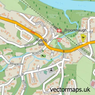
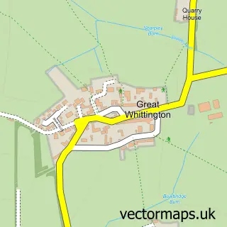
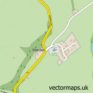
This Corbridge street map is a detailed vector street map covering a 750m x 750m area. Select a larger area to create and download your own vector street map of Corbridge.
The 750-metre map sample for Corbridge covers 279 mapped buildings and approximately 14.3 km of road detail, of which 25 named roads are named. The immediate area includes 1 GP surgery, 12 pubs and 1 MOT station. The wider area around Corbridge features 1 tourism point of interest, 20 food and drink venues and 3 hotels. To create a larger or custom map of Corbridge, the map builder lets you define your own coverage area and download editable SVG, PDF and PNG files.
Create a larger editable map of Corbridge
Choose any area you need and generate a high-quality vector map instantly. Perfect for print, planning, design, business and personal use.

This Corbridge street map in Northumberland is available as downloadable SVG, PDF and PNG map files, or as a printed map for planning, business, display, education, local information and design work. You can also create a larger custom map area using the map selector.
What this Corbridge map sample shows
Corbridge lies within Corbridge Cp parish, part of Corbridge ward in the Northumberland local authority area. The postcode geography for this area includes the NE postcode area, the NE45 postcode district and the NE45 5 postcode sector. Residents fall under the Nhs North East And North Cumbria Integrated Care Board for NHS services.
Local features near Corbridge
Within 2 milesAmenities and services in and around Corbridge.
Administrative and postcode information for Corbridge
The local authority covering Corbridge is Northumberland, within the county of Northumberland. The settlement lies within Corbridge ward and Corbridge Cp civil parish. The NE45 postcode district and NE45 5 postcode sector serve the immediate area. NHS provision in the area is delivered through Northumbria Healthcare Nhs Foundation Trust.
Nearby street map samples around Corbridge

More street maps in Northumberland
750 metre map area coverage
Boundary, postcode and point of interest information for the 750m x 750m rectangle centred on this sample map.
Boundaries containing map centre
Constituency: Hexham Co Const
District: Northumberland
Icb: NHS North East and North Cumbria ICB
Parish: Corbridge CP
Police Force: northumberland
Postcode District: NE45
Postcode Sector: NE45 5
Nearby boundaries intersecting sample
No additional intersecting boundaries found.
Postcode coverage
POI category counts
Pub: 12
Beauty Salon: 6
Cafe: 6
Clothing Store: 6
Flowers And Gifts Shop: 5
Hair Salon: 4
Art Gallery: 3
Beauty Product Supplier: 3
Hotel: 3
Jewelry Store: 3
Sample points of interest
- St Andrew's Corbridge with Halton and Newton Hall
- Corbridge Antiques Centre
- Alex Clark
- Balman Gallery Ltd.
- The Wallington Gallery
- Corbridge Framing
- Corbridge Village
- The Cooperative Food (BF) Corbridge - Hill Street
- Lisa Graham Hearingcare
- Corbridge Coachworks
- G B Motor Engineers
- Genie Gaming
Create a larger editable map of Corbridge
This sample shows only a 750 metre area. To create a larger map of Corbridge, use our map builder to choose your own coverage area, add titles and download editable SVG, PDF and PNG files.
Create a custom map of Corbridge