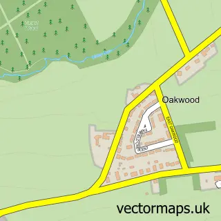
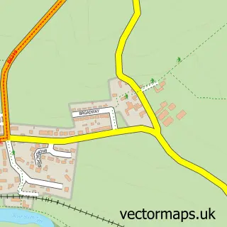
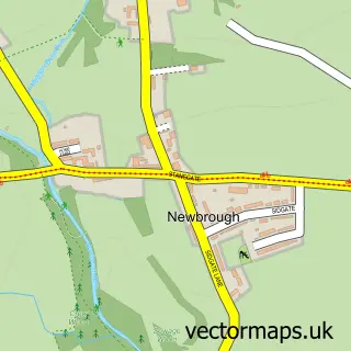
This Hexham street map is a detailed vector street map covering a 750m x 750m area. Select a larger area to create and download your own vector street map of Hexham.
The 750-metre map sample for Hexham covers 241 mapped buildings and approximately 17.5 km of road detail, of which 53 named roads are named. The immediate area includes 2 primary schools and 1 secondary school, 2 GP surgeries within 2 miles, 13 pubs and 2 MOT stations, with 8 within 2 miles. The wider area around Hexham features 15 tourism points of interest, 37 food and drink venues and 14 hotels. To create a larger or custom map of Hexham, the map builder lets you define your own coverage area and download editable SVG, PDF and PNG files.
Create a larger editable map of Hexham
Choose any area you need and generate a high-quality vector map instantly. Perfect for print, planning, design, business and personal use.

This Hexham street map in Northumberland is available as downloadable SVG, PDF and PNG map files, or as a printed map for planning, business, display, education, local information and design work. You can also create a larger custom map area using the map selector.
What this Hexham map sample shows
Hexham lies within Hexham Cp parish, part of Hexham East ward in the Northumberland local authority area. The postcode geography for this area includes the NE postcode area, the NE46 postcode district and the NE46 1 postcode sector. Residents fall under the Nhs North East And North Cumbria Integrated Care Board for NHS services.
Local features near Hexham
Within 2 milesAmenities and services in and around Hexham.
Administrative and postcode information for Hexham
The local authority covering Hexham is Northumberland, within the county of Northumberland. The settlement lies within Hexham East ward and Hexham Cp civil parish. The NE46 postcode district and NE46 1 postcode sector serve the immediate area. NHS provision in the area is delivered through Northumbria Healthcare Nhs Foundation Trust.
Nearby street map samples around Hexham

More street maps in Northumberland
750 metre map area coverage
Boundary, postcode and point of interest information for the 750m x 750m rectangle centred on this sample map.
Boundaries containing map centre
Constituency: Hexham Co Const
District: Northumberland
Icb: NHS North East and North Cumbria ICB
Parish: Hexham CP
Police Force: northumberland
Postcode District: NE46
Postcode Sector: NE46 1
Nearby boundaries intersecting sample
Postcode Sector: NE46 2, NE46 3
Postcode coverage
POI category counts
Hair Salon: 15
Hotel: 14
Clothing Store: 13
Pub: 13
Real Estate Agent: 13
Beauty Salon: 11
Cafe: 11
Coffee Shop: 10
Bank Credit Union: 9
Barber: 9
Sample points of interest
- Azets - Accountants & Business Advisors
- CI Accountancy Limited
- Hexham Acupuncture & Physiotherapy Clinic
- Concern Training
- Creative Edge
- Acomb Taxis
- Age UK
- Ashbourne House Antiques
- Instinct Antiques
- Malcolm Eglin Antiques
- Northumberland Antique Centre
- Opulence Jewellery and Antiques
Create a larger editable map of Hexham
This sample shows only a 750 metre area. To create a larger map of Hexham, use our map builder to choose your own coverage area, add titles and download editable SVG, PDF and PNG files.
Create a custom map of Hexham