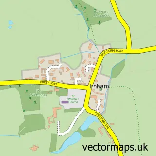
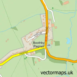
This Corby Glen street map is a detailed vector street map covering a 750m x 750m area. Select a larger area to create and download your own vector street map of Corby Glen.
The 750-metre map sample for Corby Glen covers 304 mapped buildings and approximately 21.8 km of road detail, of which 18 named roads are named. The immediate area includes 1 primary school and 1 secondary school, 1 GP surgery within 2 miles, 3 pubs and 1 MOT station. The wider area around Corby Glen features 5 food and drink venues. To create a larger or custom map of Corby Glen, the map builder lets you define your own coverage area and download editable SVG, PDF and PNG files.
Create a larger editable map of Corby Glen
Choose any area you need and generate a high-quality vector map instantly. Perfect for print, planning, design, business and personal use.

This Corby Glen street map in Lincolnshire is available as downloadable SVG, PDF and PNG map files, or as a printed map for planning, business, display, education, local information and design work. You can also create a larger custom map area using the map selector.
What this Corby Glen map sample shows
Corby Glen lies within Corby Glen Cp parish, part of Castle ward in the South Kesteven District local authority area. The postcode geography for this area includes the NG postcode area, the NG33 postcode district and the NG33 4 postcode sector. Residents fall under the Nhs Lincolnshire Integrated Care Board for NHS services.
Local features near Corby Glen
Within 2 milesAmenities and services in and around Corby Glen.
Administrative and postcode information for Corby Glen
The local authority covering Corby Glen is South Kesteven District, within the county of Lincolnshire. The settlement lies within Castle ward and Corby Glen Cp civil parish. The NG33 postcode district and NG33 4 postcode sector serve the immediate area. NHS provision in the area is delivered through United Lincolnshire Hospitals Nhs Trust.
Nearby street map samples around Corby Glen

More street maps in Lincolnshire
750 metre map area coverage
Boundary, postcode and point of interest information for the 750m x 750m rectangle centred on this sample map.
Boundaries containing map centre
Constituency: Rutland and Stamford Co Const
County: Lincolnshire County
District: South Kesteven District
Icb: NHS Lincolnshire ICB
Parish: Corby Glen CP
Police Force: lincolnshire
Postcode District: NG33
Postcode Sector: NG33 4
Ward: Castle Ward
Nearby boundaries intersecting sample
No additional intersecting boundaries found.
Postcode coverage
POI category counts
Pub: 3
Art Gallery: 2
Beauty Salon: 2
Church Cathedral: 2
Coffee Shop: 2
Wholesaler: 2
Anglican Church: 1
Auto Loan Provider: 1
Automotive Services And Repair: 1
Banks: 1
Sample points of interest
- St John the Evangelist, Corby Glen
- Willoughby Memorial Art Gallery
- Willoughby Memorial Trust
- Wyke Financial Limited
- A J Computing
- AJP Rentals
- Ali-Gance Beauty
- Allure Beauty Retreat
- Mad Hatters Bed and Breakfast
- Glen Valley Cycles
- David Wilson Homes - Pastures Place
- Pyhän evankelista Johanneksen kirkko (Corby Glen)
Create a larger editable map of Corby Glen
This sample shows only a 750 metre area. To create a larger map of Corby Glen, use our map builder to choose your own coverage area, add titles and download editable SVG, PDF and PNG files.
Create a custom map of Corby Glen