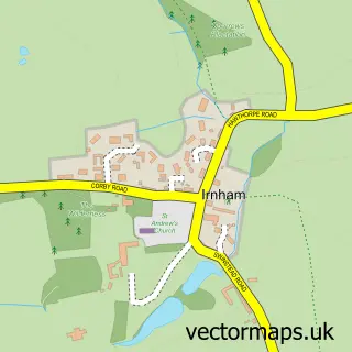
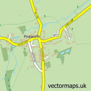
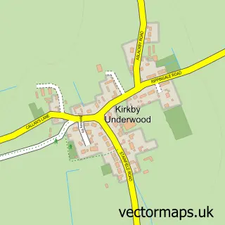
This Ingoldsby street map is a detailed vector street map covering a 750m x 750m area. Select a larger area to create and download your own vector street map of Ingoldsby.
The 750-metre map sample for Ingoldsby covers 130 mapped buildings and approximately 8.6 km of road detail, of which 7 named roads are named. The wider area around Ingoldsby features 1 tourism point of interest. To create a larger or custom map of Ingoldsby, the map builder lets you define your own coverage area and download editable SVG, PDF and PNG files.
Create a larger editable map of Ingoldsby
Choose any area you need and generate a high-quality vector map instantly. Perfect for print, planning, design, business and personal use.

This Ingoldsby street map in Lincolnshire is available as downloadable SVG, PDF and PNG map files, or as a printed map for planning, business, display, education, local information and design work. You can also create a larger custom map area using the map selector.
What this Ingoldsby map sample shows
Ingoldsby lies within Ingoldsby Cp parish, part of Lincrest ward in the South Kesteven District local authority area. The postcode geography for this area includes the NG postcode area, the NG33 postcode district and the NG33 4 postcode sector. Residents fall under the Nhs Lincolnshire Integrated Care Board for NHS services.
Local features near Ingoldsby
Within 2 milesAmenities and services in and around Ingoldsby.
Administrative and postcode information for Ingoldsby
Ingoldsby lies within Ingoldsby Cp parish, part of Lincrest ward in the South Kesteven District local authority area. The postcode geography for this area includes the NG postcode area, the NG33 postcode district and the NG33 4 postcode sector. Residents fall under the Nhs Lincolnshire Integrated Care Board for NHS services.
Nearby street map samples around Ingoldsby
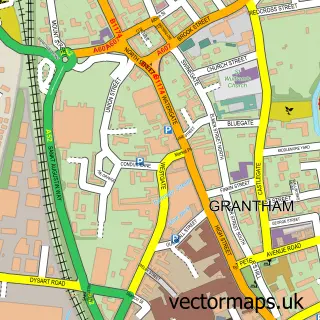

More street maps in Lincolnshire
750 metre map area coverage
Boundary, postcode and point of interest information for the 750m x 750m rectangle centred on this sample map.
Boundaries containing map centre
Constituency: Grantham and Bourne Co Const
County: Lincolnshire County
District: South Kesteven District
Icb: NHS Lincolnshire ICB
Parish: Ingoldsby CP
Police Force: lincolnshire
Postcode District: NG33
Postcode Sector: NG33 4
Ward: Lincrest Ward
Nearby boundaries intersecting sample
No additional intersecting boundaries found.
Postcode coverage
POI category counts
Anglican Church: 1
Contractor: 1
Importer And Exporter: 1
Landmark And Historical Building: 1
Nursery And Gardening: 1
Party Supply: 1
Social Service Organizations: 1
Sample points of interest
- St Bartholomew's, Ingoldsby - at the heart of the community for 900 years
- Stuart J Radley General Building Services
- Mad Textiles
- Ingoldsby
- Lincolnshire Plant Supports Ltd
- Rainbow Lane Creations
- Ingoldsby Social Club
Create a larger editable map of Ingoldsby
This sample shows only a 750 metre area. To create a larger map of Ingoldsby, use our map builder to choose your own coverage area, add titles and download editable SVG, PDF and PNG files.
Create a custom map of Ingoldsby