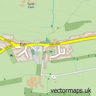
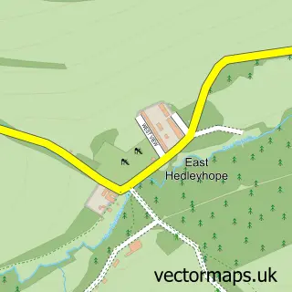
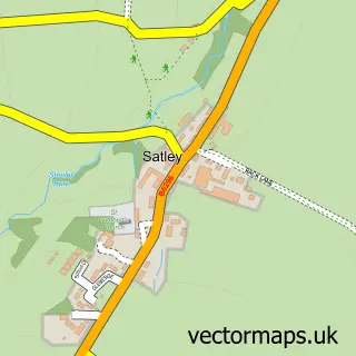
This Cornsay Colliery street map is a detailed vector street map covering a 750m x 750m area. Select a larger area to create and download your own vector street map of Cornsay Colliery.
The 750-metre map sample for Cornsay Colliery covers 61 mapped buildings and approximately 7.2 km of road detail, of which 5 named roads are named. The immediate area includes 1 pub and 4 MOT stations within 2 miles. The wider area around Cornsay Colliery features 2 tourism points of interest, 1 food and drink venue and 1 hotel. To create a larger or custom map of Cornsay Colliery, the map builder lets you define your own coverage area and download editable SVG, PDF and PNG files.
Create a larger editable map of Cornsay Colliery
Choose any area you need and generate a high-quality vector map instantly. Perfect for print, planning, design, business and personal use.

This Cornsay Colliery street map in Durham is available as downloadable SVG, PDF and PNG map files, or as a printed map for planning, business, display, education, local information and design work. You can also create a larger custom map area using the map selector.
What this Cornsay Colliery map sample shows
Cornsay Colliery lies within Esh Cp parish, part of Esh And Witton Gilbert ward in the County Durham local authority area. The postcode geography for this area includes the DH postcode area, the DH7 postcode district and the DH7 9 postcode sector. Residents fall under the Nhs North East And North Cumbria Integrated Care Board for NHS services.
Local features near Cornsay Colliery
Within 2 milesAmenities and services in and around Cornsay Colliery.
Administrative and postcode information for Cornsay Colliery
Cornsay Colliery lies within Esh Cp parish, part of Esh And Witton Gilbert ward in the County Durham local authority area. The postcode geography for this area includes the DH postcode area, the DH7 postcode district and the DH7 9 postcode sector. Residents fall under the Nhs North East And North Cumbria Integrated Care Board for NHS services.
Nearby street map samples around Cornsay Colliery

More street maps in Durham
750 metre map area coverage
Boundary, postcode and point of interest information for the 750m x 750m rectangle centred on this sample map.
Boundaries containing map centre
Constituency: City of Durham Co Const
District: County Durham
Icb: NHS North East and North Cumbria ICB
Parish: Cornsay CP
Police Force: durham
Postcode District: DH7
Postcode Sector: DH7 9
Nearby boundaries intersecting sample
Parish: Esh CP
Postcode coverage
POI category counts
Antique Store: 1
Automotive Repair: 1
Boxing Class: 1
Brake Service And Repair: 1
Contractor: 1
Convenience Store: 1
Equestrian Facility: 1
Guest House: 1
Holiday Rental Home: 1
Hotel: 1
Sample points of interest
- The Fashion Studio
- G.G'S - Gelder's Garage Services
- Newhouse boxing club
- North East Remaps - Quantum Tuning Dealer
- Finley Bros Demolition
- Commercial convenience store
- Cornsay Horses
- The Royal Oak
- Colliery Cottage Cornsay Colliery
- The royal hotel
- Cornsay Colliery
- Truby Tool Hire
Create a larger editable map of Cornsay Colliery
This sample shows only a 750 metre area. To create a larger map of Cornsay Colliery, use our map builder to choose your own coverage area, add titles and download editable SVG, PDF and PNG files.
Create a custom map of Cornsay Colliery