Vector Maps logo
Home Why it works Popular maps Districts Samples Customizer Create Your Map
VectorMaps.uk
Home Popular maps Districts Samples Customizer Create Your Map Privacy Disclaimer
Home / UK Maps / East Riding of Yorkshire / Cottingham Map

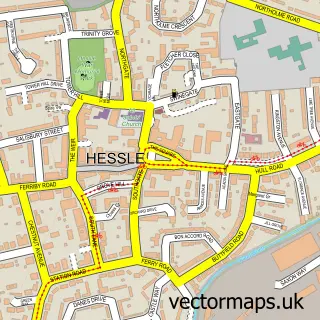
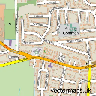
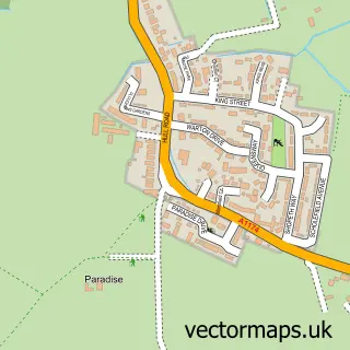
This Cottingham street map is a detailed vector street map covering a 750m x 750m area. Select a larger area to create and download your own vector street map of Cottingham.

Cottingham is a village in East Riding Of Yorkshire, in the Yorkshire And The Humber of England. Historically, the area formed part of Yorkshire. The settlement falls within the Haltemprice And Howden parliamentary constituency. It is served by the HU16 p

The 750-metre map sample for Cottingham covers 537 mapped buildings and approximately 17.2 km of road detail, of which 42 named roads are named. The immediate area includes 2 schools, 2 GP surgeries within 2 miles, 12 pubs and 6 MOT stations within 2 miles. The wider area around Cottingham features 1 tourism point of interest and 24 food and drink venues. To create a larger or custom map of Cottingham, the map builder lets you define your own coverage area and download editable SVG, PDF and PNG files.

537Buildings
17.2 kmRoads
42Named roads
25,424Residents within 2 miles
Create your own

Create a larger editable map of Cottingham

Choose any area you need and generate a high-quality vector map instantly. Perfect for print, planning, design, business and personal use.

Choose any location
Editable SVG files
Any size up to A0
PDF, PNG & more
Instant download
High quality guaranteed
Create My Custom Map
Secure, private & no credit card required
Cottingham Vector Street Map
750m Sample
Cottingham vector street map sample showing roads, buildings and local features in a 750 metre preview area
Buy Cottingham Map Print from £12.95 Buy Cottingham Digital Map from £6

This Cottingham street map in East Riding of Yorkshire is available as downloadable SVG, PDF and PNG map files, or as a printed map for planning, business, display, education, local information and design work. You can also create a larger custom map area using the map selector.

What this Cottingham map sample shows

Cottingham lies within Cottingham Cp parish, part of Cottingham South ward in the East Riding Of Yorkshire local authority area. The postcode geography for this area includes the HU postcode area, the HU16 postcode district and the HU16 4 postcode sector. Residents fall under the Nhs Humber And North Yorkshire Integrated Care Board for NHS services.

Local features near Cottingham

Within 2 miles

Amenities and services in and around Cottingham.

2 Schools
2 GP surgeries within 2 miles
6 MOT stations within 2 miles
1 Tourism & leisure
24 Food & drink
12 Pubs
8 Healthcare POIs
1 Vehicle services

Counts are approximate and based on publicly available data.

Administrative and postcode information for Cottingham

The local authority covering Cottingham is East Riding Of Yorkshire, within the county of East Riding Of Yorkshire. The settlement lies within Cottingham South ward and Cottingham Cp civil parish. The HU16 postcode district and HU16 4 postcode sector serve the immediate area. NHS provision in the area is delivered through Hull University Teaching Hospitals Nhs Trust.

Parish Cottingham CP
Ward Cottingham South
District / local authority East Riding of Yorkshire
County East Riding of Yorkshire
Historic county Yorkshire
Postcode district HU16
Postcode sector HU16 4
Parliamentary constituency Haltemprice and Howden
Region Yorkshire and the Humber
Country England

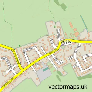
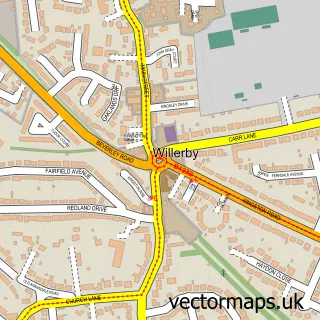
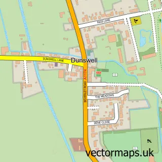
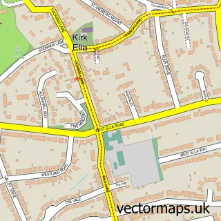
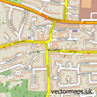
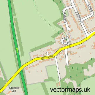
Nearby street map samples around Cottingham

Street map sample of Hessle, East Riding of Yorkshire Hessle Town - East Riding of Yorkshire - 4.0 miles Street map sample of Hull, East Riding of Yorkshire Hull City - East Riding of Yorkshire - 4.1 miles Street map sample of Skidby, East Riding of Yorkshire Skidby Village - East Riding of Yorkshire - 1.9 miles Street map sample of Willerby, East Riding of Yorkshire Willerby Village - East Riding of Yorkshire - 2.0 miles Street map sample of Dunswell, East Riding of Yorkshire Dunswell Village - East Riding of Yorkshire - 2.3 miles Street map sample of Anlaby Common, East Riding of Yorkshire Anlaby Common Village - East Riding of Yorkshire - 2.4 miles Street map sample of Kirk Ella, East Riding of Yorkshire Kirk Ella Village - East Riding of Yorkshire - 2.5 miles Street map sample of Anlaby, East Riding of Yorkshire Anlaby Village - East Riding of Yorkshire - 2.5 miles Street map sample of West Ella, East Riding of Yorkshire West Ella Village - East Riding of Yorkshire - 3.1 miles Street map sample of Woodmansey, East Riding of Yorkshire Woodmansey Village - East Riding of Yorkshire - 3.2 miles

More street maps in East Riding of Yorkshire

Street map sample of Skidby, East Riding of Yorkshire Skidby Village - 1.9 miles Street map sample of Willerby, East Riding of Yorkshire Willerby Village - 2.0 miles Street map sample of Dunswell, East Riding of Yorkshire Dunswell Village - 2.3 miles Street map sample of Anlaby Common, East Riding of Yorkshire Anlaby Common Village - 2.4 miles Street map sample of Kirk Ella, East Riding of Yorkshire Kirk Ella Village - 2.5 miles

750 metre map area coverage

Boundary, postcode and point of interest information for the 750m x 750m rectangle centred on this sample map.

Boundaries containing map centre

Constituency: Kingston upon Hull North and Cottingham Boro Const

District: East Riding of Yorkshire

Icb: NHS Humber and North Yorkshire ICB

Parish: Cottingham CP

Police Force: humberside

Postcode District: HU16

Postcode Sector: HU16 4

Ward: Cottingham North Ward

Nearby boundaries intersecting sample

Postcode Sector: HU16 5

Ward: Cottingham South Ward

Postcode coverage

HU16 HU16 4 HU16 5

POI category counts

Pub: 12

Beauty Salon: 10

Hair Salon: 10

Cafe: 8

Charity Organization: 6

Pharmacy: 5

Bakery: 4

Banks: 4

Chinese Restaurant: 4

Eyewear And Optician: 4

Sample points of interest

  • Cottingham Village Accommodation
  • Hallgate, Cottingham Accommodation
  • Chris Wright And Co. Accountant
  • Yorkshire Accountancy Accountant
  • Ovata Design Advertising Agency
  • The Healing Hut Alternative Medicine
  • RSPCA Animal Shelter
  • British Red Cross Antique Store
  • Ian Black Domestic Appliances Appliance Store
  • Artmarket Gallery Art Gallery
  • The Cooperative Food Cottingham Atms
  • Your Hearing Consultants Audiologist

Create a larger editable map of Cottingham

This sample shows only a 750 metre area. To create a larger map of Cottingham, use our map builder to choose your own coverage area, add titles and download editable SVG, PDF and PNG files.

Create a custom map of Cottingham

Phone 01751 473136 | Copyright Vectormaps.uk 2026

Samples Customizer Privacy Disclaimer
Cottingham Vector Street Map
Cottingham enlarged street map sample showing a 750 metre preview area