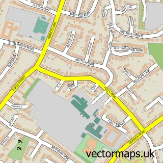
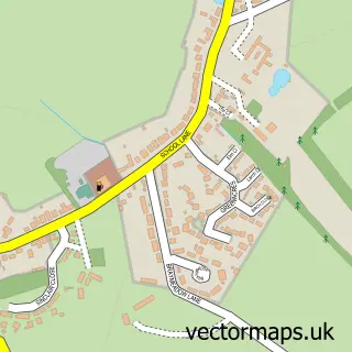
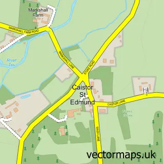
This Cringleford street map is a detailed vector street map covering a 750m x 750m area. Select a larger area to create and download your own vector street map of Cringleford.
The 750-metre map sample for Cringleford covers 455 mapped buildings and approximately 17.3 km of road detail, of which 26 named roads are named. The immediate area includes 1 GP surgery, with 3 within 2 miles and 8 MOT stations within 2 miles. The wider area around Cringleford features 1 tourism point of interest. To create a larger or custom map of Cringleford, the map builder lets you define your own coverage area and download editable SVG, PDF and PNG files.
Create a larger editable map of Cringleford
Choose any area you need and generate a high-quality vector map instantly. Perfect for print, planning, design, business and personal use.

This Cringleford street map in Norfolk is available as downloadable SVG, PDF and PNG map files, or as a printed map for planning, business, display, education, local information and design work. You can also create a larger custom map area using the map selector.
What this Cringleford map sample shows
Cringleford lies within Cringleford Cp parish, part of Cringleford ward in the South Norfolk District local authority area. The postcode geography for this area includes the NR postcode area, the NR4 postcode district and the NR4 7 postcode sector. Residents fall under the Nhs Norfolk And Waveney Integrated Care Board for NHS services.
Local features near Cringleford
Within 2 milesAmenities and services in and around Cringleford.
Administrative and postcode information for Cringleford
The local authority covering Cringleford is South Norfolk District, within the county of Norfolk. The settlement lies within Cringleford ward and Cringleford Cp civil parish. The NR4 postcode district and NR4 7 postcode sector serve the immediate area. NHS provision in the area is delivered through Norfolk And Norwich University Hospitals Nhs Foundation Trust.
Nearby street map samples around Cringleford

More street maps in Norfolk
750 metre map area coverage
Boundary, postcode and point of interest information for the 750m x 750m rectangle centred on this sample map.
Boundaries containing map centre
Constituency: South Norfolk Co Const
County: Norfolk County
District: South Norfolk District
Icb: NHS Norfolk and Waveney ICB
Parish: Cringleford CP
Police Force: norfolk
Postcode District: NR4
Postcode Sector: NR4 6
Ward: Cringleford Ward
Nearby boundaries intersecting sample
Postcode Sector: NR4 7
Postcode coverage
POI category counts
Building Supply Store: 5
Doctor: 3
Veterinarian: 3
Childbirth Education: 2
Professional Services: 2
Accommodation: 1
Acupuncture: 1
Anglican Church: 1
Arts And Entertainment: 1
Assisted Living Facility: 1
Sample points of interest
- Student Houses Norwich
- Three Treasures Clinic - Acupuncture
- St Peter's, Cringleford
- Charlotte Ashenden Portraits
- Hill Grove Care Home
- Auction House East Anglia
- Drive Cool
- Batemans Chartered Surveyors
- Jewson
- Jewson Kitchens Norwich
- Jewson Norwich - Newmarket Road
- R S Plumbing & Heating
Create a larger editable map of Cringleford
This sample shows only a 750 metre area. To create a larger map of Cringleford, use our map builder to choose your own coverage area, add titles and download editable SVG, PDF and PNG files.
Create a custom map of Cringleford