Vector Maps logo
Home Why it works Popular maps Districts Samples Customizer Create Your Map
VectorMaps.uk
Home Popular maps Districts Samples Customizer Create Your Map Privacy Disclaimer
Home / UK Maps / Ayrshire and Arran / Cumnock Map

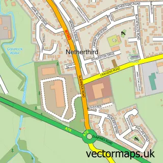
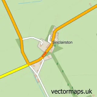
This Cumnock street map is a detailed vector street map covering a 750m x 750m area. Select a larger area to create and download your own vector street map of Cumnock.

Cumnock is a town in Ayrshire And Arran, in the South Scotland of Scotland. Historically, the area formed part of Ayrshire. The settlement falls within the Ayr, Carrick And Cumnock parliamentary constituency. It is served by the KA18 postcode district, wi

The 750-metre map sample for Cumnock covers 344 mapped buildings and approximately 17.8 km of road detail, of which 33 named roads are named. The immediate area includes 1 GP surgery, with 2 within 2 miles, 4 pubs and 3 MOT stations, with 6 within 2 miles. The wider area around Cumnock features 3 tourism points of interest, 12 food and drink venues and 3 hotels. To create a larger or custom map of Cumnock, the map builder lets you define your own coverage area and download editable SVG, PDF and PNG files.

344Buildings
17.83 kmRoads
33Named roads
0Residents within 2 miles
Create your own

Create a larger editable map of Cumnock

Choose any area you need and generate a high-quality vector map instantly. Perfect for print, planning, design, business and personal use.

Choose any location
Editable SVG files
Any size up to A0
PDF, PNG & more
Instant download
High quality guaranteed
Create My Custom Map
Secure, private & no credit card required
Cumnock Vector Street Map
750m Sample
Cumnock vector street map sample showing roads, buildings and local features in a 750 metre preview area
Buy Cumnock Map Print from £12.95 Buy Cumnock Digital Map from £6

This Cumnock street map in Ayrshire and Arran is available as downloadable SVG, PDF and PNG map files, or as a printed map for planning, business, display, education, local information and design work. You can also create a larger custom map area using the map selector.

What this Cumnock map sample shows

Cumnock lies within East Ayrshire parish, part of Cumnock And New Cumnock ward in the East Ayrshire local authority area. The postcode geography for this area includes the KA postcode area, the KA18 postcode district and the KA18 1 postcode sector. Residents fall under the Ayrshire And Arran for NHS services.

Local features near Cumnock

Within 2 miles

Amenities and services in and around Cumnock.

1 GP surgeries 2 within 2 miles
3 MOT stations 6 within 2 miles
3 Tourism & leisure
12 Food & drink
4 Pubs
3 Hotels
10 Healthcare POIs
7 Vehicle services

Counts are approximate and based on publicly available data.

Administrative and postcode information for Cumnock

The local authority covering Cumnock is East Ayrshire, within the county of Ayrshire And Arran. The settlement lies within Cumnock And New Cumnock ward and East Ayrshire civil parish. The KA18 postcode district and KA18 1 postcode sector serve the immediate area. NHS provision in the area is delivered through Ayrshire And Arran.

Parish EAST AYRSHIRE
Ward Cumnock and New Cumnock
District / local authority East Ayrshire
County Ayrshire and Arran
Historic county Ayrshire
Postcode district KA18
Postcode sector KA18 1
Parliamentary constituency Ayr, Carrick and Cumnock
Region South Scotland
Country Scotland

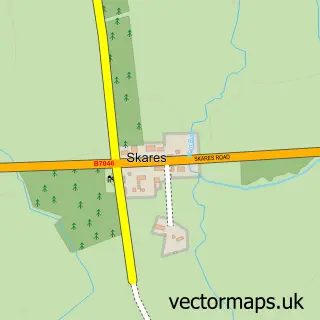
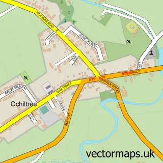
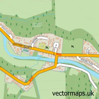
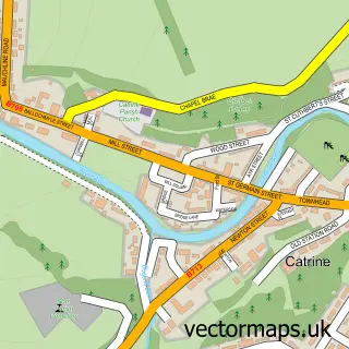
Nearby street map samples around Cumnock

Street map sample of Glasgow, City of Glasgow Glasgow City - City of Glasgow - 28.1 miles Street map sample of Netherthird, Ayrshire and Arran Netherthird Village - Ayrshire and Arran - 1.1 miles Street map sample of Logan, Ayrshire and Arran Logan Village - Ayrshire and Arran - 1.3 miles Street map sample of Lugar, Ayrshire and Arran Lugar Village - Ayrshire and Arran - 1.5 miles Street map sample of Auchinleck, Ayrshire and Arran Auchinleck Village - Ayrshire and Arran - 1.6 miles Street map sample of Skares, Ayrshire and Arran Skares Village - Ayrshire and Arran - 2.8 miles Street map sample of Ochiltree, Ayrshire and Arran Ochiltree Village - Ayrshire and Arran - 3.8 miles Street map sample of Sorn, Ayrshire and Arran Sorn Village - Ayrshire and Arran - 4.0 miles Street map sample of Catrine, Ayrshire and Arran Catrine Village - Ayrshire and Arran - 4.3 miles Street map sample of Sinclairston, Ayrshire and Arran Sinclairston Village - Ayrshire and Arran - 6.4 miles

More street maps in Ayrshire and Arran

Street map sample of Netherthird, Ayrshire and Arran Netherthird Village - 1.1 miles Street map sample of Logan, Ayrshire and Arran Logan Village - 1.3 miles Street map sample of Lugar, Ayrshire and Arran Lugar Village - 1.5 miles Street map sample of Auchinleck, Ayrshire and Arran Auchinleck Village - 1.6 miles Street map sample of Skares, Ayrshire and Arran Skares Village - 2.8 miles

750 metre map area coverage

Boundary, postcode and point of interest information for the 750m x 750m rectangle centred on this sample map.

Boundaries containing map centre

Constituency: Ayr, Carrick and Cumnock Co Const

District: East Ayrshire

Icb: Ayrshire and Arran

Postcode District: KA18

Postcode Sector: KA18 1

Ward: Cumnock and New Cumnock Ward

Nearby boundaries intersecting sample

No additional intersecting boundaries found.

Postcode coverage

KA18 KA18 1

POI category counts

Beauty Salon: 9

Convenience Store: 7

Hair Salon: 7

Barber: 6

Fast Food Restaurant: 5

Bank Credit Union: 4

Banks: 4

Church Cathedral: 4

Gas Station: 4

Grocery Store: 4

Sample points of interest

  • Senjokai Karate Academy - Cumnock Active Life
  • The Studio at Millbank Art Gallery
  • Healthcare Plus Rcruitment Ltd. Assisted Living Facility
  • Halfords McConechy's Cumnock Autocentre Automotive Parts And Accessories
  • Gibsons Auto Services Automotive Repair
  • Gibsons Auto Services Automotive Repair
  • McConechys Cumnock Automotive Repair
  • Greggs Bakery
  • Greggs Bakery
  • Stobbs Cumnock Bakery
  • Bank of Scotland Bank Credit Union
  • Cumnock&Doon Vall Credit Unio Bank Credit Union

Create a larger editable map of Cumnock

This sample shows only a 750 metre area. To create a larger map of Cumnock, use our map builder to choose your own coverage area, add titles and download editable SVG, PDF and PNG files.

Create a custom map of Cumnock

Phone 01751 473136 | Copyright Vectormaps.uk 2026

Samples Customizer Privacy Disclaimer
Cumnock Vector Street Map
Cumnock enlarged street map sample showing a 750 metre preview area