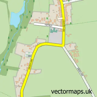
This Cumnor street map is a detailed vector street map covering a 750m x 750m area. Select a larger area to create and download your own vector street map of Cumnor.
The 750-metre map sample for Cumnor covers 247 mapped buildings and approximately 22.1 km of road detail, of which 14 named roads are named. The immediate area includes 1 school, 1 pub and 1 MOT station within 2 miles. The wider area around Cumnor features 1 food and drink venue, 1 hotel and 1 campsite within 2 miles. To create a larger or custom map of Cumnor, the map builder lets you define your own coverage area and download editable SVG, PDF and PNG files.
Create a larger editable map of Cumnor
Choose any area you need and generate a high-quality vector map instantly. Perfect for print, planning, design, business and personal use.

This Cumnor street map in Oxfordshire is available as downloadable SVG, PDF and PNG map files, or as a printed map for planning, business, display, education, local information and design work. You can also create a larger custom map area using the map selector.
What this Cumnor map sample shows
Cumnor lies within Cumnor Cp parish, part of Cumnor ward in the Vale Of White Horse District local authority area. The postcode geography for this area includes the OX postcode area, the OX2 postcode district and the OX2 9 postcode sector. Residents fall under the Nhs Buckinghamshire, Oxfordshire And Berkshire West Integrated Care Board for NHS services.
Local features near Cumnor
Within 2 milesAmenities and services in and around Cumnor.
Administrative and postcode information for Cumnor
Cumnor lies within Cumnor Cp parish, part of Cumnor ward in the Vale Of White Horse District local authority area. The postcode geography for this area includes the OX postcode area, the OX2 postcode district and the OX2 9 postcode sector. Residents fall under the Nhs Buckinghamshire, Oxfordshire And Berkshire West Integrated Care Board for NHS services.
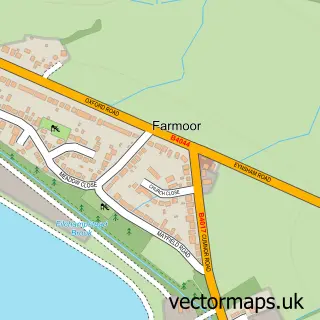
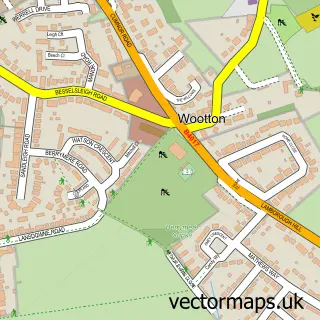
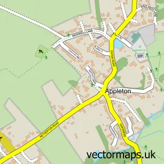
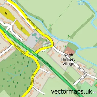
Nearby street map samples around Cumnor


More street maps in Oxfordshire
750 metre map area coverage
Boundary, postcode and point of interest information for the 750m x 750m rectangle centred on this sample map.
Boundaries containing map centre
Constituency: Oxford West and Abingdon Co Const
County: Oxfordshire County
District: Vale of White Horse District
Icb: NHS Thames Valley ICB
Parish: Cumnor CP
Police Force: thames valley
Postcode District: OX2
Postcode Sector: OX2 9
Ward: Cumnor Ward
Nearby boundaries intersecting sample
No additional intersecting boundaries found.
Postcode coverage
POI category counts
Post Office: 3
Retirement Home: 2
Accommodation: 1
Accountant: 1
Alternative Medicine: 1
Anglican Church: 1
Art Gallery: 1
Automotive Repair: 1
Chemical Plant: 1
Church Cathedral: 1
Sample points of interest
- Cumnor Place
- Whitecross Accountancy
- Cumnor Clinic
- St Michael's, Cumnor
- V a Prints
- Cumnor Garage
- Cumnor Gas Services
- St Michael's Church
- Cumnor Cricket Club
- Oxfordshire County Council
- Cumnor C of E Primary School
- A Taste of Vietnam - Vietnamese Street Food
Create a larger editable map of Cumnor
This sample shows only a 750 metre area. To create a larger map of Cumnor, use our map builder to choose your own coverage area, add titles and download editable SVG, PDF and PNG files.
Create a custom map of Cumnor