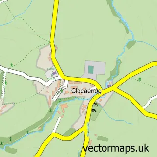
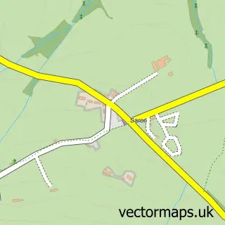
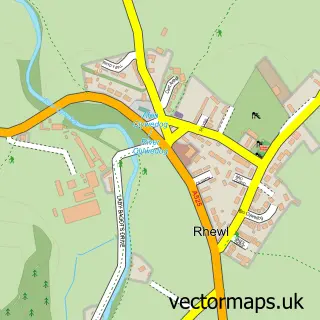
This Cyffylliog street map is a detailed vector street map covering a 750m x 750m area. Select a larger area to create and download your own vector street map of Cyffylliog.
The 750-metre map sample for Cyffylliog covers 68 mapped buildings and approximately 15.0 km of road detail, of which 1 named road are named. The wider area around Cyffylliog features 1 hotel and 1 campsite within 2 miles. To create a larger or custom map of Cyffylliog, the map builder lets you define your own coverage area and download editable SVG, PDF and PNG files.
Create a larger editable map of Cyffylliog
Choose any area you need and generate a high-quality vector map instantly. Perfect for print, planning, design, business and personal use.

This Cyffylliog street map in Clwyd is available as downloadable SVG, PDF and PNG map files, or as a printed map for planning, business, display, education, local information and design work. You can also create a larger custom map area using the map selector.
What this Cyffylliog map sample shows
Cyffylliog lies within Cyffylliog Community parish, part of Llanrhaeadr-Yng-Nghinmeirch ward in the Sir Ddinbych - Denbighshire local authority area. The postcode geography for this area includes the LL postcode area, the LL15 postcode district and the LL15 2 postcode sector. Residents fall under the Betsi Cadwaladr University Health Board for NHS services.
Local features near Cyffylliog
Within 2 milesAmenities and services in and around Cyffylliog.
Administrative and postcode information for Cyffylliog
Cyffylliog lies within Cyffylliog Community parish, part of Llanrhaeadr-Yng-Nghinmeirch ward in the Sir Ddinbych - Denbighshire local authority area. The postcode geography for this area includes the LL postcode area, the LL15 postcode district and the LL15 2 postcode sector. Residents fall under the Betsi Cadwaladr University Health Board for NHS services.
Nearby street map samples around Cyffylliog

More street maps in Clwyd
750 metre map area coverage
Boundary, postcode and point of interest information for the 750m x 750m rectangle centred on this sample map.
Boundaries containing map centre
Constituency: Bangor Aberconwy Co Const
District: Sir Ddinbych - Denbighshire
Icb: Betsi Cadwaladr University
Parish: Cyffylliog Community
Police Force: north wales
Postcode District: LL15
Postcode Sector: LL15 2
Nearby boundaries intersecting sample
No additional intersecting boundaries found.
Postcode coverage
POI category counts
Agriculture: 1
Hotel: 1
Human Resource Services: 1
Travel: 1
Sample points of interest
- Kelly Equestrian / McGregor Fleet Services
- Red Lion Hotel
- LC Management Consulting
- New Experience Holidays
Create a larger editable map of Cyffylliog
This sample shows only a 750 metre area. To create a larger map of Cyffylliog, use our map builder to choose your own coverage area, add titles and download editable SVG, PDF and PNG files.
Create a custom map of Cyffylliog