Vector Maps logo
Home Why it works Popular maps Districts Samples Customizer Create Your Map
VectorMaps.uk
Home Popular maps Districts Samples Customizer Create Your Map Privacy Disclaimer
Home / UK Maps / Western Isles / Dalabrog Map

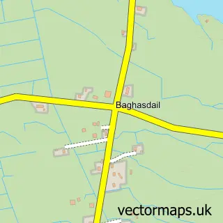
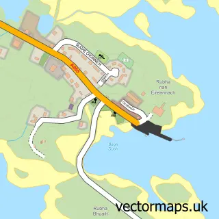
This Dalabrog street map is a detailed vector street map covering a 750m x 750m area. Select a larger area to create and download your own vector street map of Dalabrog.

Dalabrog is a village in Western Isles, in the Highlands And Islands of Scotland. Historically, the area formed part of Inverness-Shire. The settlement falls within the Na H-Eileanan An Iar parliamentary constituency. It is served by the HS8 postcode dist

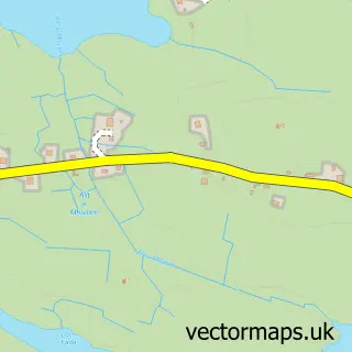
The 750-metre map sample for Dalabrog covers 28 mapped buildings and approximately 6.5 km of road detail. The immediate area includes 1 GP surgery. The wider area around Dalabrog features 1 hotel. To create a larger or custom map of Dalabrog, the map builder lets you define your own coverage area and download editable SVG, PDF and PNG files.

28Buildings
6.53 kmRoads
0Named roads
0Residents within 2 miles
Create your own

Create a larger editable map of Dalabrog

Choose any area you need and generate a high-quality vector map instantly. Perfect for print, planning, design, business and personal use.

Choose any location
Editable SVG files
Any size up to A0
PDF, PNG & more
Instant download
High quality guaranteed
Create My Custom Map
Secure, private & no credit card required
Dalabrog Vector Street Map
750m Sample
Dalabrog vector street map sample showing roads, buildings and local features in a 750 metre preview area
Buy Dalabrog Map Print from £12.95 Buy Dalabrog Digital Map from £6

This Dalabrog street map in Western Isles is available as downloadable SVG, PDF and PNG map files, or as a printed map for planning, business, display, education, local information and design work. You can also create a larger custom map area using the map selector.

What this Dalabrog map sample shows

Dalabrog lies within Na H-Eileanan An Iar parish, part of Barraigh, Bhatarsaigh, Eirisgeigh Agus Uibhist A Deas ward in the Na H-Eileanan An Iar local authority area. The postcode geography for this area includes the HS postcode area, the HS8 postcode district and the HS8 5 postcode sector. Residents fall under the Western Isles for NHS services.

Local features near Dalabrog

Within 2 miles

Amenities and services in and around Dalabrog.

1 GP surgeries 1 within 2 miles
1 Hotels
1 Healthcare POIs

Counts are approximate and based on publicly available data.

Administrative and postcode information for Dalabrog

Dalabrog lies within Na H-Eileanan An Iar parish, part of Barraigh, Bhatarsaigh, Eirisgeigh Agus Uibhist A Deas ward in the Na H-Eileanan An Iar local authority area. The postcode geography for this area includes the HS postcode area, the HS8 postcode district and the HS8 5 postcode sector. Residents fall under the Western Isles for NHS services.

Parish NA H-EILEANAN AN IAR
Ward Barraigh, Bhatarsaigh, Eirisgeigh agus Uibhist a Deas
District / local authority Na h-Eileanan an Iar
County Western Isles
Historic county Inverness-shire
Postcode district HS8
Postcode sector HS8 5
Parliamentary constituency Na h-Eileanan an Iar
Region Highlands and Islands
Country Scotland

Nearby street map samples around Dalabrog

Street map sample of Portree, Ross and Cromarty Portree Town - Ross and Cromarty - 47.1 miles Street map sample of Inverness, Inverness Inverness City - Inverness - 119.3 miles Street map sample of Cille Pheadair, Western Isles Cille Pheadair Village - Western Isles - 1.3 miles Street map sample of Aisgernis, Western Isles Aisgernis Village - Western Isles - 1.7 miles Street map sample of Baghasdail, Western Isles Baghasdail Village - Western Isles - 2.2 miles Street map sample of Loch Baghasdail, Western Isles Loch Baghasdail Village - Western Isles - 2.6 miles Street map sample of Taobh a Deas Loch Baghasdail, Western Isles Taobh a Deas Loch Baghasdail Village - Western Isles - 2.6 miles Street map sample of Leth Meadhanach, Western Isles Leth Meadhanach Village - Western Isles - 2.7 miles Street map sample of Fròbost, Western Isles Fròbost Village - Western Isles - 2.7 miles Street map sample of Geàrraidh na Mònadh, Western Isles Geàrraidh na Mònadh Village - Western Isles - 3.0 miles

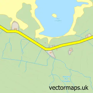
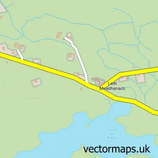
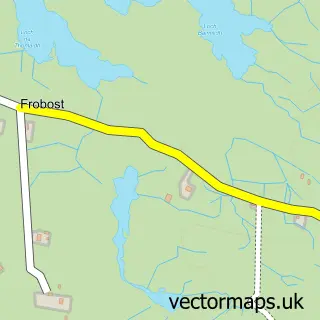
More street maps in Western Isles

Street map sample of Cille Pheadair, Western Isles Cille Pheadair Village - 1.3 miles Street map sample of Aisgernis, Western Isles Aisgernis Village - 1.7 miles Street map sample of Baghasdail, Western Isles Baghasdail Village - 2.2 miles Street map sample of Loch Baghasdail, Western Isles Loch Baghasdail Village - 2.6 miles Street map sample of Taobh a Deas Loch Baghasdail, Western Isles Taobh a Deas Loch Baghasdail Village - 2.6 miles

750 metre map area coverage

Boundary, postcode and point of interest information for the 750m x 750m rectangle centred on this sample map.

Boundaries containing map centre

Constituency: Na h-Eileanan an Iar Co Const

District: Na h-Eileanan an Iar

Icb: Western Isles

Postcode District: HS8

Postcode Sector: HS8 5

Ward: Uibhist a Deas, Eirisgeigh agus Beinn na Faoghla Ward

Nearby boundaries intersecting sample

No additional intersecting boundaries found.

Postcode coverage

HS8 HS8 5

POI category counts

Community Services Non Profits: 2

Catholic Church: 1

Community Center: 1

Cultural Center: 1

Doctor: 1

Grocery Store: 1

Hotel: 1

Korean Grocery Store: 1

Medical Center: 1

Music School: 1

Sample points of interest

  • South Uist Catholic Church
  • Southend Community Hall Community Center
  • Ceolas Community Services Non Profits
  • Southend Community Hall - Daliburgh Community Services Non Profits
  • Cnoc Soilleir Cultural Center
  • South Uist Medical Practice (Isle of South Uist) Doctor
  • Co-op Grocery Store
  • Borrodale Hotel Hotel
  • Co. Operative Food Korean Grocery Store
  • South Uist Medical Practice Medical Center
  • Ceolas Music School
  • Daliburgh Post Office Post Office

Create a larger editable map of Dalabrog

This sample shows only a 750 metre area. To create a larger map of Dalabrog, use our map builder to choose your own coverage area, add titles and download editable SVG, PDF and PNG files.

Create a custom map of Dalabrog

Phone 01751 473136 | Copyright Vectormaps.uk 2026

Samples Customizer Privacy Disclaimer
Dalabrog Vector Street Map
Dalabrog enlarged street map sample showing a 750 metre preview area