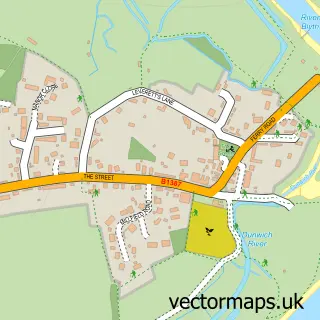
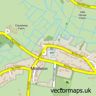
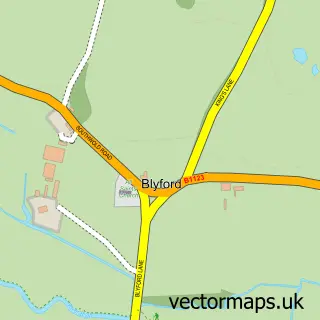
This Dunwich street map is a detailed vector street map covering a 750m x 750m area. Select a larger area to create and download your own vector street map of Dunwich.
The 750-metre map sample for Dunwich covers 69 mapped buildings and approximately 6.9 km of road detail, of which 4 named roads are named. The immediate area includes 1 pub. The wider area around Dunwich features 3 tourism points of interest, 1 food and drink venue and 2 hotels. To create a larger or custom map of Dunwich, the map builder lets you define your own coverage area and download editable SVG, PDF and PNG files.
Create a larger editable map of Dunwich
Choose any area you need and generate a high-quality vector map instantly. Perfect for print, planning, design, business and personal use.

This Dunwich street map in Suffolk is available as downloadable SVG, PDF and PNG map files, or as a printed map for planning, business, display, education, local information and design work. You can also create a larger custom map area using the map selector.
What this Dunwich map sample shows
Dunwich lies within Dunwich Cp parish, part of Wrentham, Wangford & Westleton ward in the East Suffolk District local authority area. The postcode geography for this area includes the IP postcode area, the IP17 postcode district and the IP17 3 postcode sector. Residents fall under the Nhs Suffolk And North East Essex Integrated Care Board for NHS services.
Local features near Dunwich
Within 2 milesAmenities and services in and around Dunwich.
Administrative and postcode information for Dunwich
Dunwich lies within Dunwich Cp parish, part of Wrentham, Wangford & Westleton ward in the East Suffolk District local authority area. The postcode geography for this area includes the IP postcode area, the IP17 postcode district and the IP17 3 postcode sector. Residents fall under the Nhs Suffolk And North East Essex Integrated Care Board for NHS services.
Nearby street map samples around Dunwich

More street maps in Suffolk
750 metre map area coverage
Boundary, postcode and point of interest information for the 750m x 750m rectangle centred on this sample map.
Boundaries containing map centre
Constituency: Suffolk Coastal Co Const
County: Suffolk County
District: East Suffolk District
Icb: NHS Essex ICB
Parish: Dunwich CP
Police Force: suffolk
Postcode District: IP17
Postcode Sector: IP17 3
Ward: Wrentham, Wangford & Westleton Ward
Nearby boundaries intersecting sample
Parish: Westleton CP
Postcode coverage
POI category counts
Beach: 2
Hotel: 2
Active Life: 1
Anglican Church: 1
Attractions And Activities: 1
Bed And Breakfast: 1
Church Cathedral: 1
Fish And Chips Restaurant: 1
Landmark And Historical Building: 1
Museum: 1
Sample points of interest
- Dunwich Greyfriars
- Dunwich, St James
- Greyfriars Woods
- Dunwich Beach
- The Beach - Dunwich
- Dingle Marsh Barns
- St James Church
- Flora Tea Rooms, Dunwich
- Bridge Nurseries
- The Crown Inn, Snape
- Greyfriars Medieval Friary
- Dunwich Museum
Create a larger editable map of Dunwich
This sample shows only a 750 metre area. To create a larger map of Dunwich, use our map builder to choose your own coverage area, add titles and download editable SVG, PDF and PNG files.
Create a custom map of Dunwich