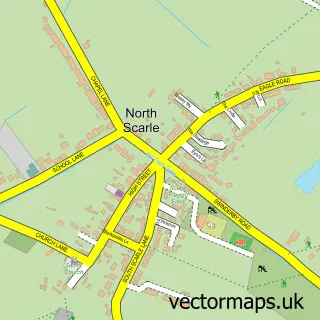
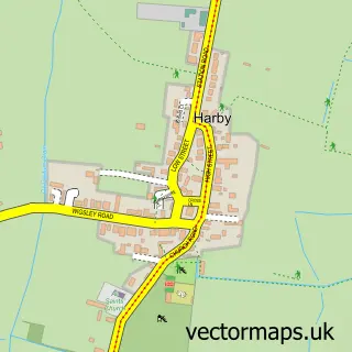
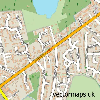
This Eagle street map is a detailed vector street map covering a 750m x 750m area. Select a larger area to create and download your own vector street map of Eagle.
The 750-metre map sample for Eagle covers 244 mapped buildings and approximately 12.2 km of road detail, of which 14 named roads are named. The immediate area includes 1 school and 1 pub. The wider area around Eagle features 1 food and drink venue. To create a larger or custom map of Eagle, the map builder lets you define your own coverage area and download editable SVG, PDF and PNG files.
Create a larger editable map of Eagle
Choose any area you need and generate a high-quality vector map instantly. Perfect for print, planning, design, business and personal use.

This Eagle street map in Lincolnshire is available as downloadable SVG, PDF and PNG map files, or as a printed map for planning, business, display, education, local information and design work. You can also create a larger custom map area using the map selector.
What this Eagle map sample shows
Eagle lies within Eagle And Swinethorpe Cp parish, part of Eagle, Swinderby And Witham St Hughs ward in the North Kesteven District local authority area. The postcode geography for this area includes the LN postcode area, the LN6 postcode district and the LN6 9 postcode sector. Residents fall under the Nhs Lincolnshire Integrated Care Board for NHS services.
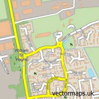
Local features near Eagle
Within 2 milesAmenities and services in and around Eagle.
Administrative and postcode information for Eagle
Eagle lies within Eagle And Swinethorpe Cp parish, part of Eagle, Swinderby And Witham St Hughs ward in the North Kesteven District local authority area. The postcode geography for this area includes the LN postcode area, the LN6 postcode district and the LN6 9 postcode sector. Residents fall under the Nhs Lincolnshire Integrated Care Board for NHS services.
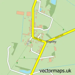
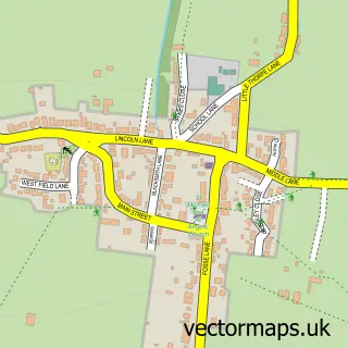
Nearby street map samples around Eagle

More street maps in Lincolnshire
750 metre map area coverage
Boundary, postcode and point of interest information for the 750m x 750m rectangle centred on this sample map.
Boundaries containing map centre
Constituency: Sleaford and North Hykeham Co Const
County: Lincolnshire County
District: North Kesteven District
Icb: NHS Lincolnshire ICB
Parish: Eagle and Swinethorpe CP
Police Force: lincolnshire
Postcode District: LN6
Postcode Sector: LN6 9
Ward: Skellingthorpe & Eagle Ward
Nearby boundaries intersecting sample
No additional intersecting boundaries found.
Postcode coverage
POI category counts
Driving School: 2
Shipping Center: 2
Active Life: 1
Alternative Medicine: 1
Anglican Church: 1
Community Center: 1
Currency Exchange: 1
Elementary School: 1
Gardener: 1
Home Service: 1
Sample points of interest
- Eagle Bowls Club
- Changing Status
- All Saints
- Eagle Village Hall
- Post Office Travel Money
- D S M
- DSM Transport Training
- Eagle Community Primary School
- County Grass Cutting Services
- Little Eagles Pre-School
- InPost
- Eagle Playing Field
Create a larger editable map of Eagle
This sample shows only a 750 metre area. To create a larger map of Eagle, use our map builder to choose your own coverage area, add titles and download editable SVG, PDF and PNG files.
Create a custom map of Eagle