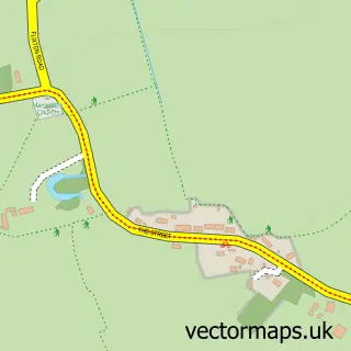
This Earsham street map is a detailed vector street map covering a 750m x 750m area. Select a larger area to create and download your own vector street map of Earsham.
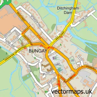
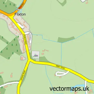
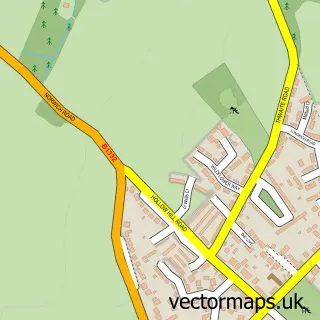
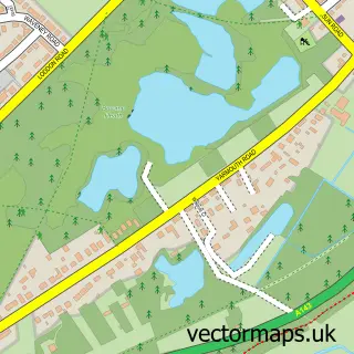
The 750-metre map sample for Earsham covers 292 mapped buildings and approximately 15.3 km of road detail, of which 21 named roads are named. The immediate area includes 1 school, 1 GP surgery within 2 miles, 3 pubs and 3 MOT stations within 2 miles. The wider area around Earsham features 1 tourism point of interest and 3 food and drink venues. To create a larger or custom map of Earsham, the map builder lets you define your own coverage area and download editable SVG, PDF and PNG files.
Create a larger editable map of Earsham
Choose any area you need and generate a high-quality vector map instantly. Perfect for print, planning, design, business and personal use.

This Earsham street map in Norfolk is available as downloadable SVG, PDF and PNG map files, or as a printed map for planning, business, display, education, local information and design work. You can also create a larger custom map area using the map selector.
What this Earsham map sample shows
Earsham lies within Earsham Cp parish, part of Ditchingham & Earsham ward in the South Norfolk District local authority area. The postcode geography for this area includes the NR postcode area, the NR35 postcode district and the NR35 2 postcode sector. Residents fall under the Nhs Norfolk And Waveney Integrated Care Board for NHS services.
Local features near Earsham
Within 2 milesAmenities and services in and around Earsham.
Administrative and postcode information for Earsham
Earsham lies within Earsham Cp parish, part of Ditchingham & Earsham ward in the South Norfolk District local authority area. The postcode geography for this area includes the NR postcode area, the NR35 postcode district and the NR35 2 postcode sector. Residents fall under the Nhs Norfolk And Waveney Integrated Care Board for NHS services.
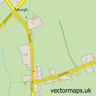
Nearby street map samples around Earsham

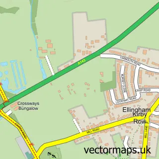
More street maps in Norfolk
750 metre map area coverage
Boundary, postcode and point of interest information for the 750m x 750m rectangle centred on this sample map.
Boundaries containing map centre
Constituency: Waveney Valley Co Const
County: Norfolk County
District: South Norfolk District
Icb: NHS Norfolk and Waveney ICB
Parish: Earsham CP
Police Force: norfolk
Postcode District: NR35
Postcode Sector: NR35 2
Ward: Ditchingham & Earsham Ward
Nearby boundaries intersecting sample
No additional intersecting boundaries found.
Postcode coverage
POI category counts
Pub: 3
Automotive Repair: 2
Building Supply Store: 2
Contractor: 2
Anglican Church: 1
Antique Store: 1
Architectural Designer: 1
Assisted Living Facility: 1
Auto Body Shop: 1
Auto Detailing: 1
Sample points of interest
- Earsham: All Saints
- Matthew Higham Antiques
- John Putman
- The Moorings
- Waters Body And Paint
- Refresh Valeting Services
- Truck Monkey Garage
- Truck Monkey Garage
- Earsham Building Supplies
- Straight Up Scaffolding
- D Way Travel
- Grumpys cafe
Create a larger editable map of Earsham
This sample shows only a 750 metre area. To create a larger map of Earsham, use our map builder to choose your own coverage area, add titles and download editable SVG, PDF and PNG files.
Create a custom map of Earsham