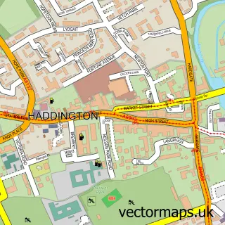
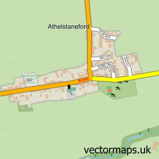
This East Linton street map is a detailed vector street map covering a 750m x 750m area. Select a larger area to create and download your own vector street map of East Linton.
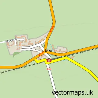
The 750-metre map sample for East Linton covers 241 mapped buildings and approximately 13.1 km of road detail, of which 22 named roads are named. The immediate area includes 1 GP surgery, 2 pubs and 2 MOT stations. The wider area around East Linton features 3 tourism points of interest and 5 food and drink venues. To create a larger or custom map of East Linton, the map builder lets you define your own coverage area and download editable SVG, PDF and PNG files.
Create a larger editable map of East Linton
Choose any area you need and generate a high-quality vector map instantly. Perfect for print, planning, design, business and personal use.

This East Linton street map in East Lothian is available as downloadable SVG, PDF and PNG map files, or as a printed map for planning, business, display, education, local information and design work. You can also create a larger custom map area using the map selector.
What this East Linton map sample shows
East Linton lies within East Lothian parish, part of Dunbar And East Linton ward in the East Lothian local authority area. The postcode geography for this area includes the EH postcode area, the EH40 postcode district and the EH40 3 postcode sector. Residents fall under the Lothian for NHS services.
Local features near East Linton
Within 2 milesAmenities and services in and around East Linton.
Administrative and postcode information for East Linton
East Linton lies within East Lothian parish, part of Dunbar And East Linton ward in the East Lothian local authority area. The postcode geography for this area includes the EH postcode area, the EH40 postcode district and the EH40 3 postcode sector. Residents fall under the Lothian for NHS services.
Nearby street map samples around East Linton

More street maps in East Lothian
750 metre map area coverage
Boundary, postcode and point of interest information for the 750m x 750m rectangle centred on this sample map.
Boundaries containing map centre
Constituency: Lothian East Co Const
District: East Lothian
Icb: Lothian
Postcode District: EH40
Postcode Sector: EH40 3
Ward: Dunbar and East Linton Ward
Nearby boundaries intersecting sample
No additional intersecting boundaries found.
Postcode coverage
POI category counts
Beauty Salon: 4
Hair Salon: 3
Acupuncture: 2
Building Supply Store: 2
Cafe: 2
Financial Service: 2
Park: 2
Pharmacy: 2
Post Office: 2
Professional Services: 2
Sample points of interest
- Fusion Acupuncture
- The Acupuncture Clinic
- Denley Inc Copywriters
- Wm WM Rose & Sons Ltd
- Hidden Cottage Finds
- Chris Rhodes Architect
- The Mart_East Linton
- Wok N Go Noodle Bar
- The Cooperative Food (BF) East Linton
- Torness Motors
- Mrs B’s Buns Bespoke Cakes
- RBS
Create a larger editable map of East Linton
This sample shows only a 750 metre area. To create a larger map of East Linton, use our map builder to choose your own coverage area, add titles and download editable SVG, PDF and PNG files.
Create a custom map of East Linton