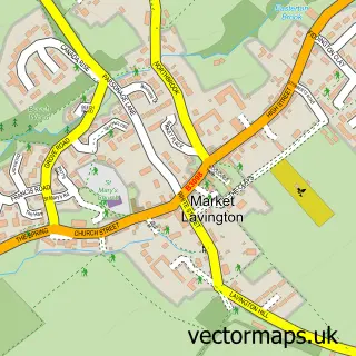
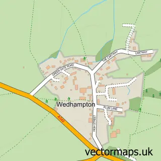
This Easterton street map is a detailed vector street map covering a 750m x 750m area. Select a larger area to create and download your own vector street map of Easterton.
The 750-metre map sample for Easterton covers 206 mapped buildings and approximately 9.3 km of road detail, of which 9 named roads are named. The immediate area includes 2 GP surgeries within 2 miles, 1 pub and 2 MOT stations within 2 miles. The wider area around Easterton features 1 food and drink venue. To create a larger or custom map of Easterton, the map builder lets you define your own coverage area and download editable SVG, PDF and PNG files.
Create a larger editable map of Easterton
Choose any area you need and generate a high-quality vector map instantly. Perfect for print, planning, design, business and personal use.

This Easterton street map in Wiltshire is available as downloadable SVG, PDF and PNG map files, or as a printed map for planning, business, display, education, local information and design work. You can also create a larger custom map area using the map selector.
What this Easterton map sample shows
Easterton lies within Easterton Cp parish, part of Urchfont And The Cannings ward in the Wiltshire local authority area. The postcode geography for this area includes the SN postcode area, the SN10 postcode district and the SN10 4 postcode sector. Residents fall under the Nhs Bath And North East Somerset, Swindon And Wiltshire Integrated Care Board for NHS services.
Local features near Easterton
Within 2 milesAmenities and services in and around Easterton.
Administrative and postcode information for Easterton
Easterton lies within Easterton Cp parish, part of Urchfont And The Cannings ward in the Wiltshire local authority area. The postcode geography for this area includes the SN postcode area, the SN10 postcode district and the SN10 4 postcode sector. Residents fall under the Nhs Bath And North East Somerset, Swindon And Wiltshire Integrated Care Board for NHS services.
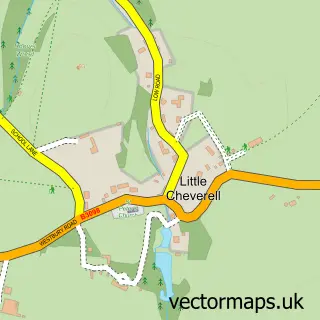
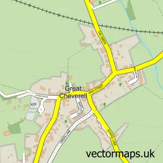
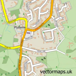
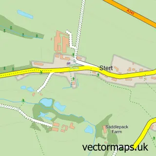
Nearby street map samples around Easterton

More street maps in Wiltshire
750 metre map area coverage
Boundary, postcode and point of interest information for the 750m x 750m rectangle centred on this sample map.
Boundaries containing map centre
Constituency: Melksham and Devizes Co Const
District: Wiltshire
Icb: NHS Bath and North East Somerset Swindon and Wiltshire ICB
Parish: Easterton CP
Police Force: wiltshire
Postcode District: SN10
Postcode Sector: SN10 4
Nearby boundaries intersecting sample
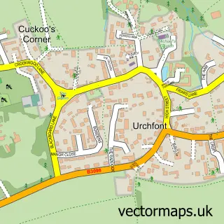
Parish: Market Lavington CP
Postcode coverage
POI category counts
Anglican Church: 1
Arts And Entertainment: 1
Business Consulting: 1
Business Management Services: 1
Community Services Non Profits: 1
Convenience Store: 1
Corporate Entertainment Services: 1
Corporate Office: 1
Dentist: 1
Holiday Rental Home: 1
Sample points of interest
- Easterton: St Barnabas
- Eastcott
- P a Desk
- PAdesk Ltd
- Easterton Market Lavington & Urchfont Link Good Neighbour Scheme
- Co-Op
- Kooky the Clown
- Agility in Mind
- Urchfont Dental Care
- Owls Cottage
- Cabin Living
- Market Lavington Post Office
Create a larger editable map of Easterton
This sample shows only a 750 metre area. To create a larger map of Easterton, use our map builder to choose your own coverage area, add titles and download editable SVG, PDF and PNG files.
Create a custom map of Easterton