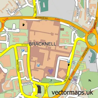
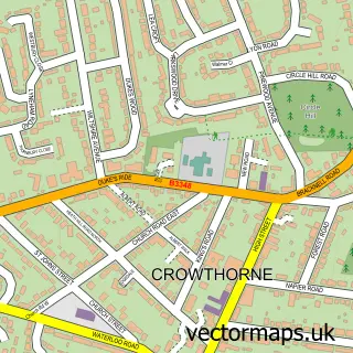
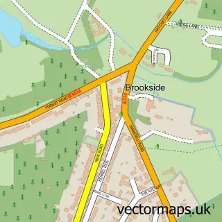
This Easthampstead street map is a detailed vector street map covering a 750m x 750m area. Select a larger area to create and download your own vector street map of Easthampstead.
The 750-metre map sample for Easthampstead covers 260 mapped buildings and approximately 16.4 km of road detail, of which 30 named roads are named. The immediate area includes 1 primary school and 1 secondary school, 1 GP surgery, with 8 within 2 miles, 2 pubs and 1 MOT station, with 15 within 2 miles. The wider area around Easthampstead features 4 food and drink venues. To create a larger or custom map of Easthampstead, the map builder lets you define your own coverage area and download editable SVG, PDF and PNG files.
Create a larger editable map of Easthampstead
Choose any area you need and generate a high-quality vector map instantly. Perfect for print, planning, design, business and personal use.

This Easthampstead street map in Berkshire is available as downloadable SVG, PDF and PNG map files, or as a printed map for planning, business, display, education, local information and design work. You can also create a larger custom map area using the map selector.
What this Easthampstead map sample shows
Easthampstead lies within Bracknell Cp parish, part of Old Bracknell ward in the Bracknell Forest (B) local authority area. The postcode geography for this area includes the RG postcode area, the RG12 postcode district and the RG12 7 postcode sector. Residents fall under the Nhs Frimley Integrated Care Board for NHS services.
Local features near Easthampstead
Within 2 milesAmenities and services in and around Easthampstead.
Administrative and postcode information for Easthampstead
Easthampstead lies within Bracknell Cp parish, part of Old Bracknell ward in the Bracknell Forest (B) local authority area. The postcode geography for this area includes the RG postcode area, the RG12 postcode district and the RG12 7 postcode sector. Residents fall under the Nhs Frimley Integrated Care Board for NHS services.
Nearby street map samples around Easthampstead

More street maps in Berkshire
750 metre map area coverage
Boundary, postcode and point of interest information for the 750m x 750m rectangle centred on this sample map.
Boundaries containing map centre
Constituency: Bracknell Boro Const
District: Bracknell Forest (B)
Icb: NHS Frimley ICB
Parish: Bracknell CP
Police Force: thames valley
Postcode District: RG12
Postcode Sector: RG12 7
Ward: Easthampstead & Wildridings Ward
Nearby boundaries intersecting sample
Postcode Sector: RG12 0, RG12 9
Ward: Harmans Water & Crown Wood Ward, Town Centre & The Parks Ward
Postcode coverage
POI category counts
Building Supply Store: 6
Martial Arts Club: 4
Gym: 3
Hair Salon: 3
Performing Arts: 3
Tutoring Center: 3
Veterinarian: 3
Atms: 2
Beauty Salon: 2
Community Services Non Profits: 2
Sample points of interest
- MW Accounting Services
- Limitless Freestyle
- Shell Little Waitrose Bracknell (655)
- The Cooperative Food Easthampstead, Easthampstead
- Thames Valley Tiles
- B.O.B Affordable Luxury Hairdressing
- Celina Zięcina Makijaż Permanentny i Okazjonalny
- Hair & Beauty Room
- A & a Property Services
- Bailey
- DB Fire Assessment Services
- David Jones Carpentry
Create a larger editable map of Easthampstead
This sample shows only a 750 metre area. To create a larger map of Easthampstead, use our map builder to choose your own coverage area, add titles and download editable SVG, PDF and PNG files.
Create a custom map of Easthampstead