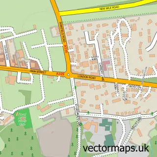
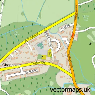
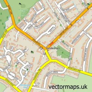
This South Ascot street map is a detailed vector street map covering a 750m x 750m area. Select a larger area to create and download your own vector street map of South Ascot.
The 750-metre map sample for South Ascot covers 304 mapped buildings and approximately 10.7 km of road detail, of which 17 named roads are named. The immediate area includes 1 school, 4 GP surgeries within 2 miles and 4 MOT stations within 2 miles. The wider area around South Ascot features 1 hotel. To create a larger or custom map of South Ascot, the map builder lets you define your own coverage area and download editable SVG, PDF and PNG files.
Create a larger editable map of South Ascot
Choose any area you need and generate a high-quality vector map instantly. Perfect for print, planning, design, business and personal use.

This South Ascot street map in Berkshire is available as downloadable SVG, PDF and PNG map files, or as a printed map for planning, business, display, education, local information and design work. You can also create a larger custom map area using the map selector.
What this South Ascot map sample shows
South Ascot lies within Sunninghill And Ascot Cp parish, part of Ascot & Sunninghill ward in the Windsor And Maidenhead (B) local authority area. The postcode geography for this area includes the SL postcode area, the SL5 postcode district and the SL5 9 postcode sector. Residents fall under the Nhs Frimley Integrated Care Board for NHS services.
Local features near South Ascot
Within 2 milesAmenities and services in and around South Ascot.
Administrative and postcode information for South Ascot
South Ascot lies within Sunninghill And Ascot Cp parish, part of Ascot & Sunninghill ward in the Windsor And Maidenhead (B) local authority area. The postcode geography for this area includes the SL postcode area, the SL5 postcode district and the SL5 9 postcode sector. Residents fall under the Nhs Frimley Integrated Care Board for NHS services.
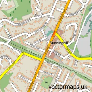
Nearby street map samples around South Ascot

More street maps in Berkshire
750 metre map area coverage
Boundary, postcode and point of interest information for the 750m x 750m rectangle centred on this sample map.
Boundaries containing map centre
Constituency: Windsor Co Const
District: Windsor and Maidenhead (B)
Icb: NHS Frimley ICB
Parish: Sunninghill and Ascot CP
Police Force: thames valley
Postcode District: SL5
Postcode Sector: SL5 9
Ward: Ascot & Sunninghill Ward
Nearby boundaries intersecting sample
No additional intersecting boundaries found.
Postcode coverage
POI category counts
Elementary School: 3
Advertising Agency: 2
Arts And Entertainment: 1
Assisted Living Facility: 1
Catholic Church: 1
Gents Tailor: 1
Hobby Shop: 1
Homeless Shelter: 1
Hotel: 1
Hvac Services: 1
Sample points of interest
- Adwordtize
- Global Brand Network
- Stagecoach Performing Arts Ascot
- Crown Hill Court
- St Francis of Assisi's Catholic Church
- ICS SKOLA Ascot
- St Francis Preschool Ascot
- St. Francis Catholic Primary School
- The Fashion Workshop
- Ascot Scale Models
- Crown Hill Court
- Brockenhurst Hotel
Create a larger editable map of South Ascot
This sample shows only a 750 metre area. To create a larger map of South Ascot, use our map builder to choose your own coverage area, add titles and download editable SVG, PDF and PNG files.
Create a custom map of South Ascot