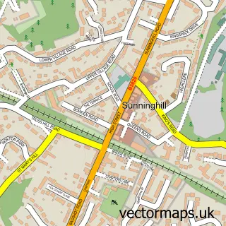
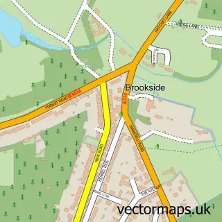
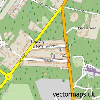
This Ascot street map is a detailed vector street map covering a 750m x 750m area. Select a larger area to create and download your own vector street map of Ascot.
The 750-metre map sample for Ascot covers 216 mapped buildings and approximately 12.5 km of road detail, of which 13 named roads are named. The immediate area includes 1 school, 4 GP surgeries within 2 miles, 2 pubs and 1 MOT station, with 4 within 2 miles. The wider area around Ascot features 1 tourism point of interest and 5 food and drink venues. To create a larger or custom map of Ascot, the map builder lets you define your own coverage area and download editable SVG, PDF and PNG files.
Create a larger editable map of Ascot
Choose any area you need and generate a high-quality vector map instantly. Perfect for print, planning, design, business and personal use.

This Ascot street map in Berkshire is available as downloadable SVG, PDF and PNG map files, or as a printed map for planning, business, display, education, local information and design work. You can also create a larger custom map area using the map selector.
What this Ascot map sample shows
Ascot lies within Sunninghill And Ascot Cp parish, part of Ascot & Sunninghill ward in the Windsor And Maidenhead (B) local authority area. The postcode geography for this area includes the SL postcode area, the SL5 postcode district and the SL5 7 postcode sector. Residents fall under the Nhs Frimley Integrated Care Board for NHS services.
Local features near Ascot
Within 2 milesAmenities and services in and around Ascot.
Administrative and postcode information for Ascot
The local authority covering Ascot is Windsor And Maidenhead (B), within the county of Berkshire. The settlement lies within Ascot & Sunninghill ward and Sunninghill And Ascot Cp civil parish. The SL5 postcode district and SL5 7 postcode sector serve the immediate area. NHS provision in the area is delivered through Frimley Health Nhs Foundation Trust.
Nearby street map samples around Ascot

More street maps in Berkshire
750 metre map area coverage
Boundary, postcode and point of interest information for the 750m x 750m rectangle centred on this sample map.
Boundaries containing map centre
Constituency: Windsor Co Const
District: Windsor and Maidenhead (B)
Icb: NHS Frimley ICB
Parish: Sunninghill and Ascot CP
Police Force: thames valley
Postcode District: SL5
Postcode Sector: SL5 7
Ward: Ascot & Sunninghill Ward
Nearby boundaries intersecting sample
Postcode Sector: SL5 9
Postcode coverage
POI category counts
Professional Services: 6
Employment Agencies: 5
Car Dealer: 4
Bar: 3
Cafe: 3
Convenience Store: 3
Education: 3
Gas Station: 3
Gym: 3
Marketing Consultant: 3
Sample points of interest
- Kirk Rice LLP
- Animated Remedy
- Loveday Antiques Ltd.
- LH1 Global
- Premier Communications
- Care Fees Planning
- Guy Salmon Jaguar Ascot
- Jay Gee Autos
- Blue Cube Connections
- Head Light
- Barclays Local
- Barclays
Create a larger editable map of Ascot
This sample shows only a 750 metre area. To create a larger map of Ascot, use our map builder to choose your own coverage area, add titles and download editable SVG, PDF and PNG files.
Create a custom map of Ascot