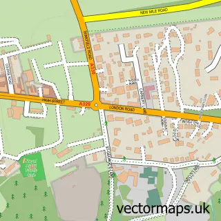
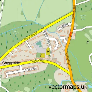
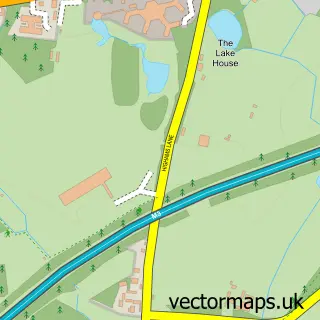
This Sunninghill street map is a detailed vector street map covering a 750m x 750m area. Select a larger area to create and download your own vector street map of Sunninghill.
The 750-metre map sample for Sunninghill covers 500 mapped buildings and approximately 15.3 km of road detail, of which 32 named roads are named. The immediate area includes 2 schools, 4 GP surgeries within 2 miles, 4 pubs and 3 MOT stations within 2 miles. The wider area around Sunninghill features 8 food and drink venues and 1 hotel. To create a larger or custom map of Sunninghill, the map builder lets you define your own coverage area and download editable SVG, PDF and PNG files.
Create a larger editable map of Sunninghill
Choose any area you need and generate a high-quality vector map instantly. Perfect for print, planning, design, business and personal use.

This Sunninghill street map in Berkshire is available as downloadable SVG, PDF and PNG map files, or as a printed map for planning, business, display, education, local information and design work. You can also create a larger custom map area using the map selector.
What this Sunninghill map sample shows
Sunninghill lies within Sunninghill And Ascot Cp parish, part of Ascot & Sunninghill ward in the Windsor And Maidenhead (B) local authority area. The postcode geography for this area includes the SL postcode area, the SL5 postcode district and the SL5 9 postcode sector. Residents fall under the Nhs Frimley Integrated Care Board for NHS services.
Local features near Sunninghill
Within 2 milesAmenities and services in and around Sunninghill.
Administrative and postcode information for Sunninghill
Sunninghill lies within Sunninghill And Ascot Cp parish, part of Ascot & Sunninghill ward in the Windsor And Maidenhead (B) local authority area. The postcode geography for this area includes the SL postcode area, the SL5 postcode district and the SL5 9 postcode sector. Residents fall under the Nhs Frimley Integrated Care Board for NHS services.
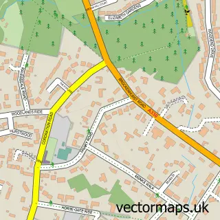
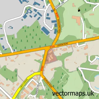
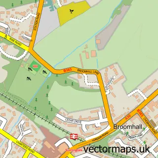
Nearby street map samples around Sunninghill

More street maps in Berkshire
750 metre map area coverage
Boundary, postcode and point of interest information for the 750m x 750m rectangle centred on this sample map.
Boundaries containing map centre
Constituency: Windsor Co Const
District: Windsor and Maidenhead (B)
Icb: NHS Frimley ICB
Parish: Sunninghill and Ascot CP
Police Force: thames valley
Postcode District: SL5
Postcode Sector: SL5 9
Ward: Ascot & Sunninghill Ward
Nearby boundaries intersecting sample
Postcode Sector: SL5 0, SL5 7
Postcode coverage
POI category counts
Professional Services: 7
Hair Salon: 6
Real Estate Agent: 6
Barber: 5
Beauty Salon: 5
Cafe: 4
Convenience Store: 4
Dentist: 4
Employment Agencies: 4
Preschool: 4
Sample points of interest
- Alexander Michael Accountants
- G M T Accountancy Services
- The Pilates Academy
- Connect Two Promotions
- Espresso Media
- Ailsa Frank Hypnotherapy Ascot
- The Circle Gallery
- Fastlane Paint and Body
- Premier Services
- Alexander David Motor Co. Ltd.
- Fastlane Ascot
- Anne Marie Patisserie
Create a larger editable map of Sunninghill
This sample shows only a 750 metre area. To create a larger map of Sunninghill, use our map builder to choose your own coverage area, add titles and download editable SVG, PDF and PNG files.
Create a custom map of Sunninghill