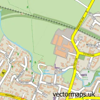
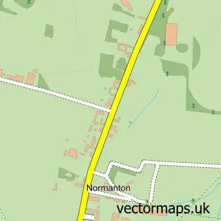
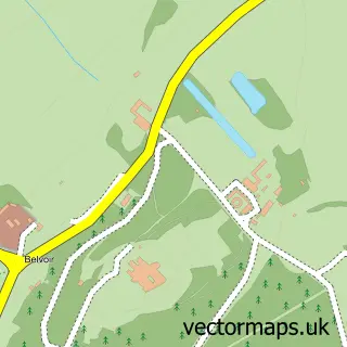
This Easthorpe street map is a detailed vector street map covering a 750m x 750m area. Select a larger area to create and download your own vector street map of Easthorpe.
The 750-metre map sample for Easthorpe covers 145 mapped buildings and approximately 9.6 km of road detail, of which 8 named roads are named. The immediate area includes 1 GP surgery within 2 miles and 2 MOT stations within 2 miles. To create a larger or custom map of Easthorpe, the map builder lets you define your own coverage area and download editable SVG, PDF and PNG files.
Create a larger editable map of Easthorpe
Choose any area you need and generate a high-quality vector map instantly. Perfect for print, planning, design, business and personal use.

This Easthorpe street map in Leicestershire is available as downloadable SVG, PDF and PNG map files, or as a printed map for planning, business, display, education, local information and design work. You can also create a larger custom map area using the map selector.
What this Easthorpe map sample shows
Easthorpe lies within Bottesford Cp parish, part of Bottesford ward in the Melton District (B) local authority area. The postcode geography for this area includes the NG postcode area, the NG13 postcode district and the NG13 0 postcode sector. Residents fall under the Nhs Leicester, Leicestershire And Rutland Integrated Care Board for NHS services.
Local features near Easthorpe
Within 2 milesAmenities and services in and around Easthorpe.
Administrative and postcode information for Easthorpe
Easthorpe lies within Bottesford Cp parish, part of Bottesford ward in the Melton District (B) local authority area. The postcode geography for this area includes the NG postcode area, the NG13 postcode district and the NG13 0 postcode sector. Residents fall under the Nhs Leicester, Leicestershire And Rutland Integrated Care Board for NHS services.
Nearby street map samples around Easthorpe

More street maps in Leicestershire
750 metre map area coverage
Boundary, postcode and point of interest information for the 750m x 750m rectangle centred on this sample map.
Boundaries containing map centre
Constituency: Melton and Syston Co Const
County: Leicestershire County
District: Melton District (B)
Icb: NHS Leicester Leicestershire and Rutland ICB
Parish: Bottesford CP
Police Force: leicestershire
Postcode District: NG13
Postcode Sector: NG13 0
Ward: Bottesford Ward
Nearby boundaries intersecting sample
No additional intersecting boundaries found.
Postcode coverage
POI category counts
Arts And Entertainment: 1
Event Technology Service: 1
Farm: 1
Land Surveying: 1
Linen: 1
Post Office: 1
Self Storage Facility: 1
Taxi Service: 1
Visitor Center: 1
Wedding Chapel: 1
Sample points of interest
- Easthorpe
- The Events & Tents Company Limited
- Goodson and Son
- Martyn Stubbs & Associates
- SFM Blinds & Shutters
- Office Buddy
- Belvoir Self Storage
- L&K Taxi
- Visit Belvoir
- Sentance Marquee Hire
Create a larger editable map of Easthorpe
This sample shows only a 750 metre area. To create a larger map of Easthorpe, use our map builder to choose your own coverage area, add titles and download editable SVG, PDF and PNG files.
Create a custom map of Easthorpe