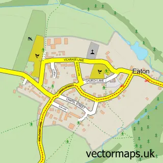
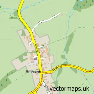
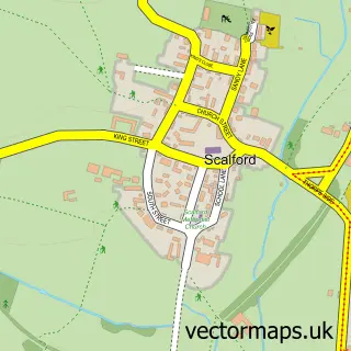
This Eastwell street map is a detailed vector street map covering a 750m x 750m area. Select a larger area to create and download your own vector street map of Eastwell.
The 750-metre map sample for Eastwell covers 96 mapped buildings and approximately 11.7 km of road detail, of which 7 named roads are named. The immediate area includes 1 MOT station within 2 miles. The wider area around Eastwell features 2 tourism points of interest. To create a larger or custom map of Eastwell, the map builder lets you define your own coverage area and download editable SVG, PDF and PNG files.
Create a larger editable map of Eastwell
Choose any area you need and generate a high-quality vector map instantly. Perfect for print, planning, design, business and personal use.

This Eastwell street map in Leicestershire is available as downloadable SVG, PDF and PNG map files, or as a printed map for planning, business, display, education, local information and design work. You can also create a larger custom map area using the map selector.
What this Eastwell map sample shows
Eastwell lies within Eaton Cp parish, part of Croxton Kerrial ward in the Melton District (B) local authority area. The postcode geography for this area includes the LE postcode area, the LE14 postcode district and the LE14 4 postcode sector. Residents fall under the Nhs Leicester, Leicestershire And Rutland Integrated Care Board for NHS services.
Local features near Eastwell
Within 2 milesAmenities and services in and around Eastwell.
Administrative and postcode information for Eastwell
The local authority covering Eastwell is Melton District (B), within the county of Leicestershire. The settlement lies within Croxton Kerrial ward and Eaton Cp civil parish. The LE14 postcode district and LE14 4 postcode sector serve the immediate area. NHS provision in the area is delivered through Nottingham University Hospitals Nhs Trust.
Nearby street map samples around Eastwell

More street maps in Leicestershire
750 metre map area coverage
Boundary, postcode and point of interest information for the 750m x 750m rectangle centred on this sample map.
Boundaries containing map centre
Constituency: Melton and Syston Co Const
County: Leicestershire County
District: Melton District (B)
Icb: NHS Leicester Leicestershire and Rutland ICB
Parish: Eaton CP
Police Force: leicestershire
Postcode District: LE14
Postcode Sector: LE14 4
Ward: Croxton Kerrial Ward
Nearby boundaries intersecting sample
No additional intersecting boundaries found.
Postcode coverage
POI category counts
Landmark And Historical Building: 2
Anglican Church: 1
Community Center: 1
Financial Service: 1
Home Cleaning: 1
Professional Services: 1
Spas: 1
Veterinarian: 1
Sample points of interest
- Eastwell: St Michael & All Angels
- Eastwell Village Hall
- Jepsons Law Costs Draftsmen
- East Mids Oven Cleaning
- Eastwell, Leicestershire
- The Blacksmith's at Eastwell
- Three Shires
- 31 Degrees Leisure Days
- Eastwell dog grooming
Create a larger editable map of Eastwell
This sample shows only a 750 metre area. To create a larger map of Eastwell, use our map builder to choose your own coverage area, add titles and download editable SVG, PDF and PNG files.
Create a custom map of Eastwell