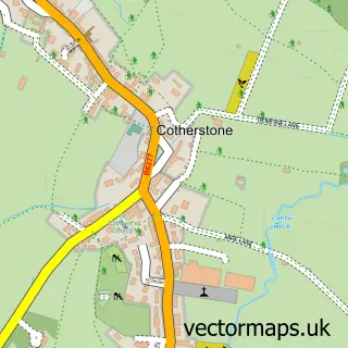
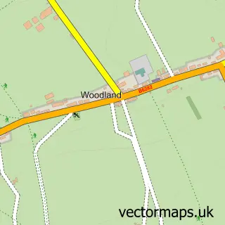
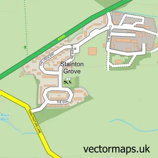
This Eggleston street map is a detailed vector street map covering a 750m x 750m area. Select a larger area to create and download your own vector street map of Eggleston.
The 750-metre map sample for Eggleston covers 97 mapped buildings and approximately 12.0 km of road detail, of which 1 named road are named. The immediate area includes 1 pub and 1 MOT station, with 2 within 2 miles. The wider area around Eggleston features 2 tourism points of interest, 2 food and drink venues and 1 hotel. To create a larger or custom map of Eggleston, the map builder lets you define your own coverage area and download editable SVG, PDF and PNG files.
Create a larger editable map of Eggleston
Choose any area you need and generate a high-quality vector map instantly. Perfect for print, planning, design, business and personal use.

This Eggleston street map in Durham is available as downloadable SVG, PDF and PNG map files, or as a printed map for planning, business, display, education, local information and design work. You can also create a larger custom map area using the map selector.
What this Eggleston map sample shows
Eggleston lies within Eggleston Cp parish, part of Barnard Castle West ward in the County Durham local authority area. The postcode geography for this area includes the DL postcode area, the DL12 postcode district and the DL12 0 postcode sector. Residents fall under the Nhs North East And North Cumbria Integrated Care Board for NHS services.
Local features near Eggleston
Within 2 milesAmenities and services in and around Eggleston.
Administrative and postcode information for Eggleston
Eggleston lies within Eggleston Cp parish, part of Barnard Castle West ward in the County Durham local authority area. The postcode geography for this area includes the DL postcode area, the DL12 postcode district and the DL12 0 postcode sector. Residents fall under the Nhs North East And North Cumbria Integrated Care Board for NHS services.
Nearby street map samples around Eggleston

More street maps in Durham
750 metre map area coverage
Boundary, postcode and point of interest information for the 750m x 750m rectangle centred on this sample map.
Boundaries containing map centre
Constituency: Bishop Auckland Co Const
District: County Durham
Icb: NHS North East and North Cumbria ICB
Parish: Eggleston CP
Police Force: durham
Postcode District: DL12
Postcode Sector: DL12 0
Nearby boundaries intersecting sample
No additional intersecting boundaries found.
Postcode coverage
POI category counts
Agricultural Cooperatives: 1
Anglican Church: 1
Architectural Designer: 1
Art Gallery: 1
Bar: 1
Botanical Garden: 1
Building Supply Store: 1
Cafe: 1
Community Services Non Profits: 1
Hotel: 1
Sample points of interest
- Seamfold Highlands
- Holy Trinity
- William Gray Associates
- Victoria Bellas Carter
- Three Tuns Inn
- Eggleston Hall Gardens
- Dave Robson Landscapes
- Eggleston Hall cafe and tearooms
- The Game & Wildlife Conservation Trust
- Stobgreen House b&b
- Eggleston Hall
- Eggleston Recreation Park
Create a larger editable map of Eggleston
This sample shows only a 750 metre area. To create a larger map of Eggleston, use our map builder to choose your own coverage area, add titles and download editable SVG, PDF and PNG files.
Create a custom map of Eggleston