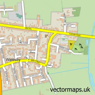
This Elkesley street map is a detailed vector street map covering a 750m x 750m area. Select a larger area to create and download your own vector street map of Elkesley.
The 750-metre map sample for Elkesley covers 188 mapped buildings and approximately 13.0 km of road detail, of which 11 named roads are named. The wider area around Elkesley features 2 food and drink venues, 2 hotels and 1 campsite within 2 miles. To create a larger or custom map of Elkesley, the map builder lets you define your own coverage area and download editable SVG, PDF and PNG files.
Create a larger editable map of Elkesley
Choose any area you need and generate a high-quality vector map instantly. Perfect for print, planning, design, business and personal use.

This Elkesley street map in Nottinghamshire is available as downloadable SVG, PDF and PNG map files, or as a printed map for planning, business, display, education, local information and design work. You can also create a larger custom map area using the map selector.
What this Elkesley map sample shows
Elkesley lies within Elkesley Cp parish, part of Welbeck ward in the Bassetlaw District local authority area. The postcode geography for this area includes the DN postcode area, the DN22 postcode district and the DN22 8 postcode sector. Residents fall under the Nhs Nottingham And Nottinghamshire Integrated Care Board for NHS services.
Local features near Elkesley
Within 2 milesAmenities and services in and around Elkesley.
Administrative and postcode information for Elkesley
Elkesley lies within Elkesley Cp parish, part of Welbeck ward in the Bassetlaw District local authority area. The postcode geography for this area includes the DN postcode area, the DN22 postcode district and the DN22 8 postcode sector. Residents fall under the Nhs Nottingham And Nottinghamshire Integrated Care Board for NHS services.
Nearby street map samples around Elkesley

More street maps in Nottinghamshire
750 metre map area coverage
Boundary, postcode and point of interest information for the 750m x 750m rectangle centred on this sample map.
Boundaries containing map centre
Constituency: Bassetlaw Co Const
County: Nottinghamshire County
District: Bassetlaw District
Icb: NHS Nottingham and Nottinghamshire ICB
Parish: Elkesley CP
Police Force: nottinghamshire
Postcode District: DN22
Postcode Sector: DN22 8
Ward: Welbeck Ward
Nearby boundaries intersecting sample
Constituency: Newark Co Const
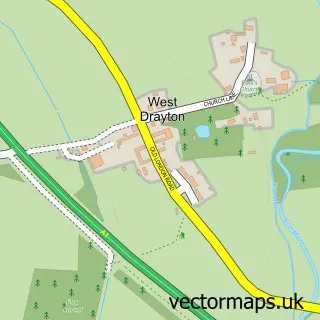
Parish: West Drayton CP
Postcode Sector: DN22 0
Ward: East Markham Ward
Postcode coverage
POI category counts
Church Cathedral: 2
Coffee Shop: 2
Hotel: 2
Post Office: 2
Airport: 1
Anglican Church: 1
Automotive Services And Repair: 1
Beer Bar: 1
Books Mags Music And Video: 1
Building Contractor: 1
Sample points of interest
- Gamston Aviation
- St Giles, Elkesley
- InstaVolt Charging Station
- A Class Mobile Bar
- Post Office-Sutton Cum Lound
- Dovetail Joinery
- RJK Digger & Development Ltd
- Whittaker Coach Builders International
- Parish of Idle and Sands, Retford
- St Giles' Church
- A1 Worksop
- Starbucks
Create a larger editable map of Elkesley
This sample shows only a 750 metre area. To create a larger map of Elkesley, use our map builder to choose your own coverage area, add titles and download editable SVG, PDF and PNG files.
Create a custom map of Elkesley